

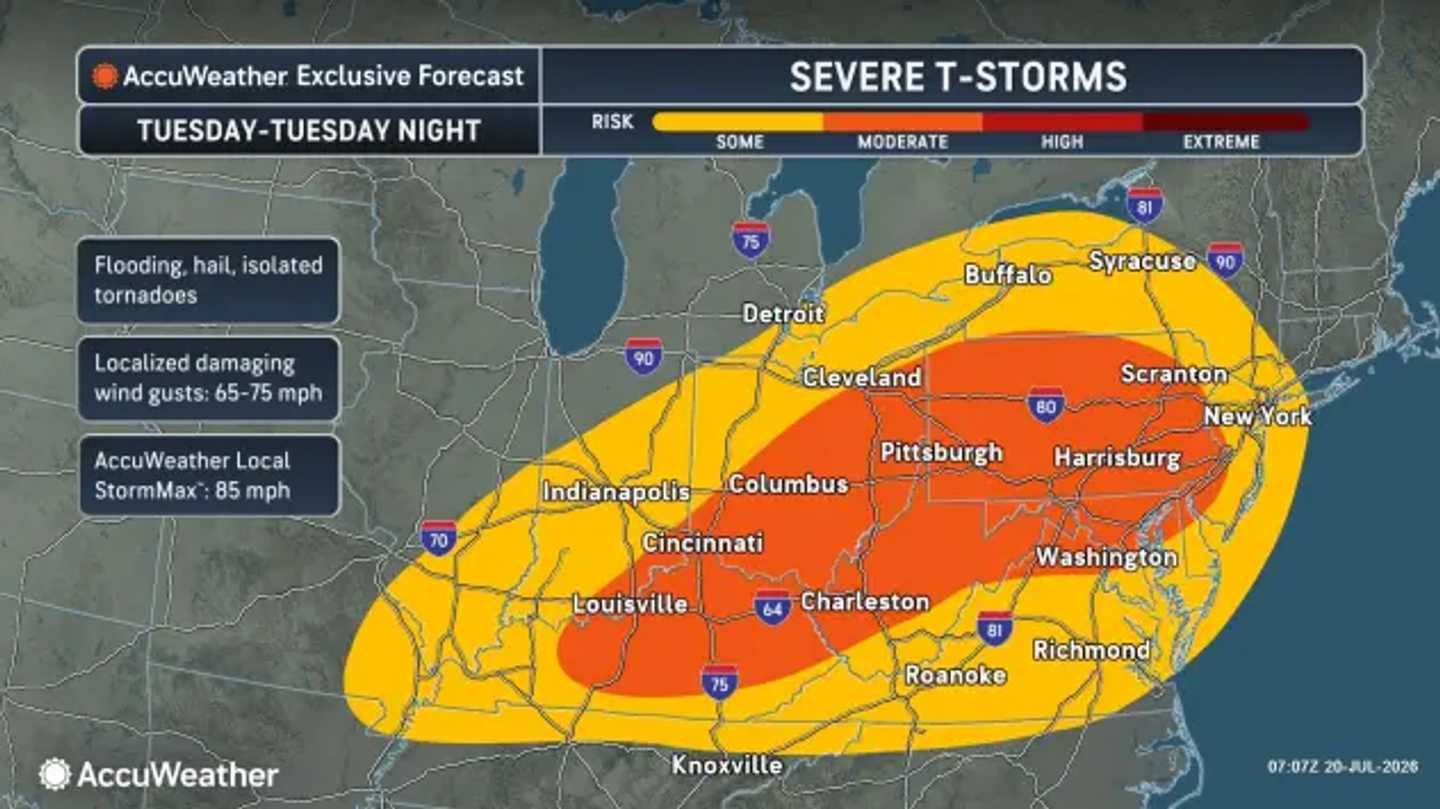

A new round of severe thunderstorms triggered by a strong cold front will sweep into the region on Tuesday, July 21, bringing damaging winds, hail, flash flooding, and a risk of tornadoes.
The National Weather Service Storm Prediction Center placed parts of Pennsylvania, Maryland, and northern Virginia under an Enhanced Risk for severe weather, the third level on its five-point scale.
A lower but still serious threat extends into New York, New Jersey, Connecticut, Massachusetts, and surrounding areas.
Numerous severe thunderstorms are expected from the Ohio Valley through the Mid-Atlantic and Northeast. The most dangerous period will stretch from Tuesday afternoon into the nighttime hours.
Damaging winds will be the primary threat. Storms could produce gusts of up to 75 mph, according to AccuWeather.
The National Weather Service said the atmosphere could support supercells and one or more bowing lines of thunderstorms. A few tornadoes may develop where individual supercells can remain organized.
The National Weather Service Weather Prediction Center has highlighted an elevated risk of excessive rainfall across portions of the region. Flash flooding is possible with rainfall amounts of 0.5 to 1 inch expected.
The pattern will be driven by a strong cold front moving into warm, humid air.
The severe threat will peak on Tuesday across much of the region. Pennsylvania, Maryland, and Virginia face the greatest danger, although strong storms could extend north and east.
Lingering showers are possible on Wednesday, July 22. The strongest storms should shift toward southern Maryland, Delaware, and the eastern Carolinas as drier air begins reaching areas farther north.
Partly sunny and more comfortable conditions should develop Thursday, July 23. Highs will range from the low 80s in New England to around 90 degrees in parts of the Mid-Atlantic.
Sunshine will become more widespread on Friday, July 24. Temperatures should reach the mid-80s across much of the Northeast and the low 90s farther south.
Wildfire smoke may remain a periodic concern as changing winds steer alternating plumes of smoke and cleaner air across the region.
Residents should monitor watches, warnings, and radar through the National Weather Service.
Check back with Daily Voice for the latest updates.
Click here to follow Daily Voice and receive free news updates.
