


The National Weather Service’s Weather Prediction Center said Monday, Nov. 2, that high pressure will keep the region dry and mild through midweek, then a frontal system will bring widespread rainfall later in the week. The change will end a dry stretch that has lasted about 2 1/2 weeks in many areas.
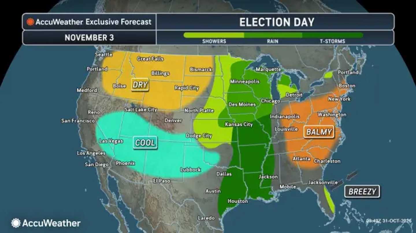
Election Day on Tuesday, Nov. 3, will bring the week’s warmest conditions. Much of the region will see sunshine, a southwest breeze, and highs in the upper 60s to low 70s. That includes the heavily traveled Interstate 95 corridor from the Mid-Atlantic through southern New England.
Clouds will increase Wednesday, Nov. 4, as the next system approaches. Most of the daylight hours should remain dry, with temperatures again reaching the upper 60s to near 70 degrees in coastal cities.
The more meaningful change arrives Thursday, Nov. 5, when a front pushes east. Rain is expected to develop first across parts of Pennsylvania, Maryland, and Virginia, then spread into New York, New Jersey, Connecticut, and Massachusetts later Thursday into Thursday night.
The Weather Prediction Center expects widespread rain across the Northeast through Friday, Nov. 6. Despite the needed rainfall, the agency said the chance of rain exceeding flash-flood guidance is less than 5 percent Thursday and Friday because dry soils should limit runoff concerns.
Cooler air will follow the front. Friday should feel more like November, with clouds, periods of rain or showers, and temperatures closer to seasonal norms. Some showers could linger near the coast as the system moves away.
The Northeast’s benign Election Day forecast differs sharply from parts of the central US, where AccuWeather says thunderstorms could disrupt travel to polling places.
Check back with Daily Voice for the latest updates.
Click here to follow Daily Voice and receive free news updates.
