

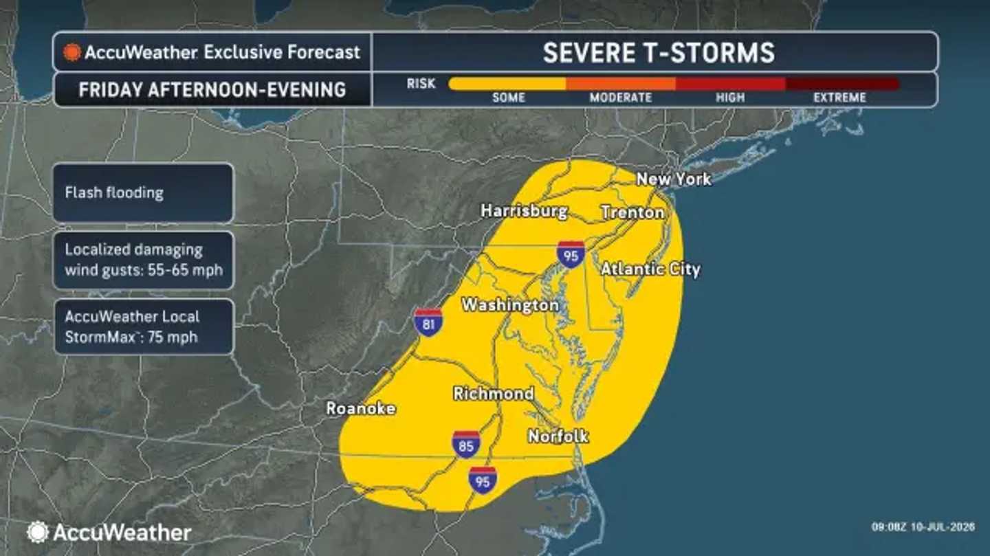


A strong cold front will help trigger the storms across much of the Northeast on Friday, July 10, with the main threat arriving during the afternoon and evening, according to the National Weather Service.
The storms will develop in humid air ahead of the front, with the highest risk east of the Appalachians and near the I-95 corridor.
Damaging wind gusts, isolated large hail, frequent lightning, and torrential downpours are the main concerns. Localized flash flooding will also be possible where storms repeatedly move over the same areas.
AccuWeather’s Friday storm map places the severe-weather zone from Virginia and the Washington, DC, area through New Jersey and toward New York City. The map also highlights flash flooding and localized damaging wind gusts of 55 to 65 mph, with an isolated 75 mph storm gust possible.
AccuWeather said severe storms are expected to favor the Mid-Atlantic during the afternoon and evening. NOAA’s Weather Prediction Center also noted a flash-flood risk associated with heavy thunderstorms and rainfall rates of around 2 inches per hour in parts of the central Appalachians and nearby areas (https://www.wpc.ncep.noaa.gov/qpf/excessive_rainfall_outlook_ero.php).
The five-day regional forecast starts with humid conditions on Friday, with scattered severe thunderstorms developing during the early afternoon and continuing into the evening. Highs will be in the mid- to upper 80s, with cooler readings near the immediate coast.
The storm threat should clear Friday night as the front moves offshore. That will open the door to a cooler and less humid weekend.
Saturday, July 11, will bring a mix of sun and clouds as the front moves away. Lingering showers are possible early in southern New England and along the Mid-Atlantic coast, but drier, more comfortable air will push in elsewhere. Highs will be in the 80s.
Sunday, July 12, will be mostly sunny and very pleasant, with highs again in the 80s.
Monday, July 13, will bring abundant sunshine and manageable humidity. Highs will be in the mid-80s.
Tuesday, July 14, will turn warmer as high pressure shifts. Clouds will increase, with the next chance for late-day pop-up showers or storms approaching from the west. Highs will be in the mid- to upper 80s.
Check back to Daily Voice for the latest updates.
Click here to follow Daily Voice and receive free news updates.
