

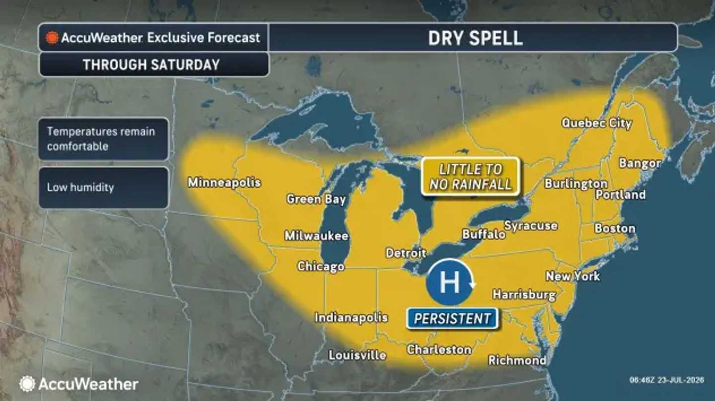


High pressure will keep most of the region comfortable with seasonable temperatures throughout the weekend, before humidity, clouds, and storm chances begin returning from west to east, according to the National Weather Service.
Temperatures will generally reach the upper 70s to mid-80s, with lower humidity making the day feel more pleasant. An isolated shower or thunderstorm could interrupt the dry spell in western Pennsylvania and the central Appalachians.
AccuWeather Meteorologist Brandon Buckingham said that “heat and humidity will build back across the Midwest by the end of the weekend, providing fuel for thunderstorm complexes capable of producing widespread damaging wind gusts, large hail and torrential downpours.”
Those storms will push east as the new week begins.
Clouds and humidity will increase on Monday, July 27, with scattered showers and thunderstorms becoming possible as an advancing front approaches the Mid-Atlantic.
The more widespread change is expected on Tuesday, July 28.
The National Weather Service’s Weather Prediction Center said an organized low-pressure system crossing the Northeast and Mid-Atlantic will combine with an upper-level disturbance to fuel numerous showers and thunderstorms from Virginia to New England.
Stronger storms could produce 1 to 2 inches of rain. Localized urban and flash flooding will be possible, especially where repeated downpours cross the same communities.
Damaging wind gusts could become the main severe-weather threat in parts of the Mid-Atlantic. Frequent lightning and sharply reduced visibility may also disrupt travel.
The exact timing will depend on how quickly the low-pressure system and its cold front move east.
Rain and lingering showers may continue into Wednesday, July 29, before coverage gradually decreases. Temperatures are expected to remain near or slightly below normal behind the front.
Residents should monitor National Weather Service alerts as the system approaches.
Check back with Daily Voice for the latest updates.
Click here to follow Daily Voice and receive free news updates.
