

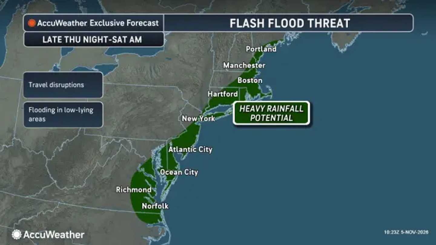


The National Weather Service expects rain to expand Thursday night, Nov. 5, into Friday, Nov. 6, with the heaviest amounts favoring coastal areas. Where the front stalls will determine which communities face the greatest flooding concern, according to NWS forecasters in Mount Holly.
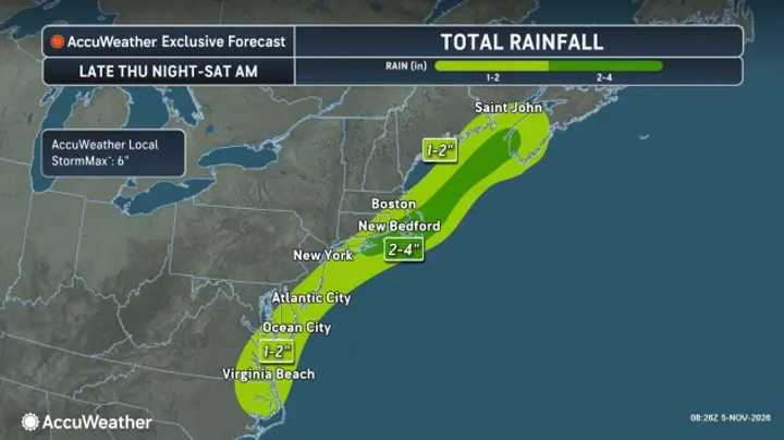
The New Jersey coast could receive 1 to 2 inches, with localized totals reaching 3 inches. Eastern Pennsylvania generally faces lighter amounts.
Farther northeast, central and eastern Long Island and southern Connecticut could receive roughly 1 to 2.25 inches. The New York City area may get closer to 0.5 inches, although the NWS New York office says a westward shift could increase totals.
Rain could persist into Saturday morning, Nov. 7, in southeastern Massachusetts, where a narrow band could deliver up to 3 inches. The NWS Boston office emphasizes urban and poor-drainage flooding, particularly where fallen leaves clog drains. Dry ground should help limit broader flooding.
AccuWeather also highlights the front’s position.
"A front is expected to stall along the mid-Atlantic and New England coasts from Friday into early Saturday," AccuWeather Senior Meteorologist Brett Anderson said. "It could focus a narrow corridor of heavy rain and embedded thunderstorms along portions of the coast from southeastern Virginia through the Delmarva Peninsula, New Jersey, Long Island, New York and southeastern Massachusetts."
Southern Maryland and Virginia’s Northern Neck could see up to 2 inches locally. However, the NWS Baltimore/Washington office does not expect flooding there, citing the prolonged dry spell.
AccuWeather warns that the first rain can mix with accumulated road residue, creating slick pavement. Wet leaves add another travel hazard.
Cooler, breezier weather follows this weekend. Some weekend showers could linger before mainly dry weather returns.
Check back to Daily Voice for the latest updates.
Click here to follow Daily Voice and receive free news updates.
