Get ready to make it seven in a row.
But this weekend, that stormy pattern may kick it up a notch.
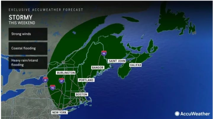
That's because forecasters are eyeing the chance for a significant storm along the East Coast that has the potential to become "a full-fledged Nor’easter, which will bring soaking rain and strong winds," according to AccuWeather.com.
The current projected possible time frame for the storm is overnight Friday, Oct. 20, through Saturday, Oct. 21, and possibly into Sunday, Oct. 22.
“The storm will strengthen significantly as it travels northward on Saturday night and Sunday and may even curl northwestward over the interior of New England,” according to AccuWeather Chief On-Air Meteorologist Bernie Rayno. “The storm is likely to evolve into a potent Nor’easter and produce a zone of heavy rain, strong winds, and building seas.”
AccuWeather Senior Meteorologist Adam Douty noted that "which areas get hit the hardest by the effects of rain and wind will depend on the track and strength of the storm, but there is the likelihood of a thorough soaking in much of the northeast US and Atlantic Canada this weekend."
There will be a mix of clouds and sun through Thursday, Oct. 19 with a high temperature in the low to mid-60s each day, according to the National Weather Service.
Ahead of the arrival of the weekend system, Friday will be cloudy with a high temperature in the mid-60s and showers becoming likely starting in the mid-afternoon.
There is still uncertainty surrounding the track, timing and strength of the weekend storm system.
Check back to Daily Voice for updates.
Click here to follow Daily Voice Arlington and receive free news updates.


