One-Week Forecast

  1. Current
    Overcast and Breezy 45°
    • 45°
    • 25°
    Overcast and Breezy
  2. Tue 12/12
    Mostly Sunny
    • 44°
    • 29°
    Mostly Sunny
  3. Wed 12/13
    Mostly Sunny
    • 42°
    • 24°
    Mostly Sunny
  4. Thu 12/14
    Sunny
    • 41°
    • 27°
    Sunny
  5. Fri 12/15
    Mostly Sunny
    • 50°
    • 31°
    Mostly Sunny
  6. Sat 12/16
    Mostly Cloudy
    • 49°
    • 29°
    Mostly Cloudy
  7. Sun 12/17
    Mostly Cloudy
    • 49°
    Mostly Cloudy
Timing On Powerful Storm Bringing Snow, High Winds To Much Of PA Timing On Powerful Storm Bringing Snow, High Winds To Much Of PA
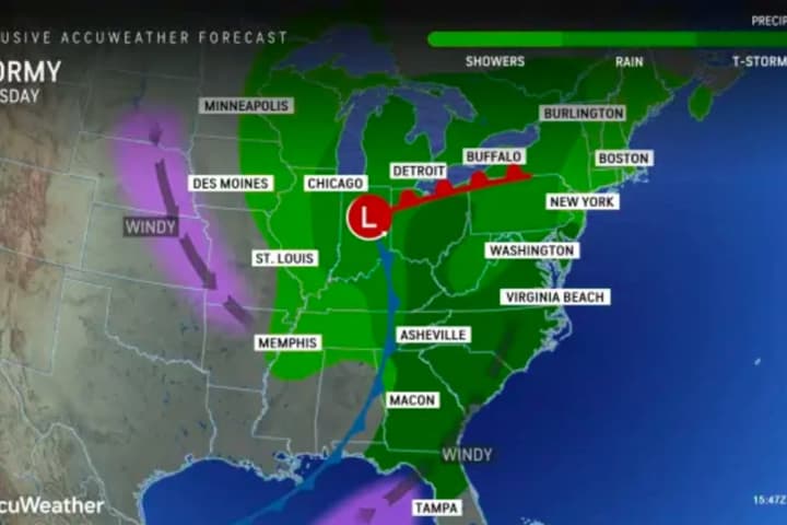
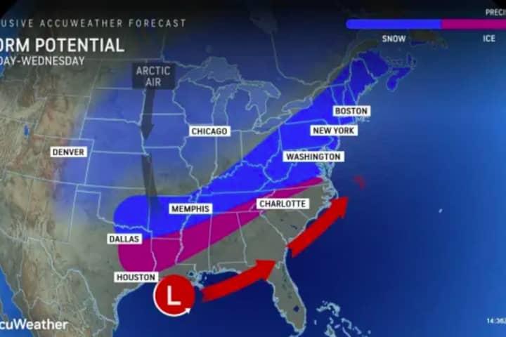
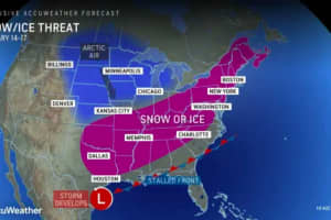
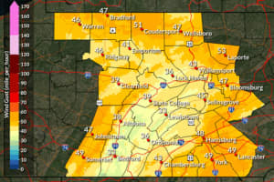
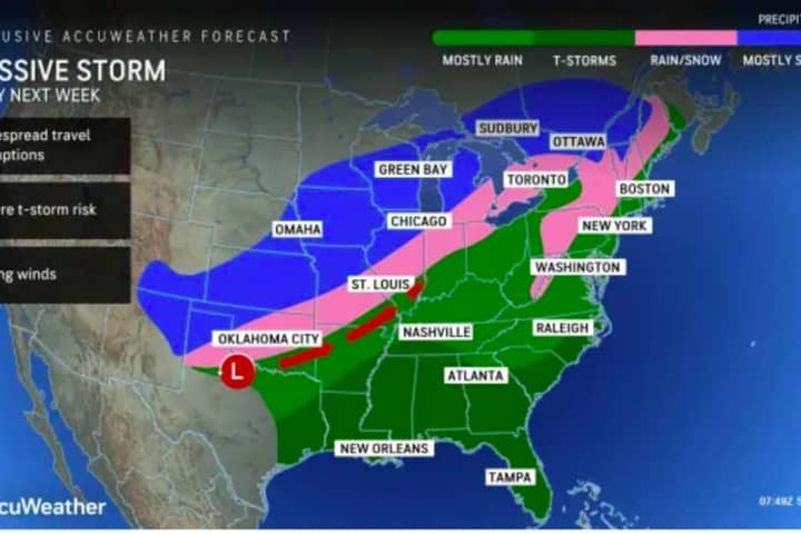
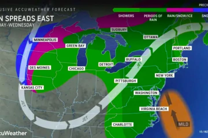
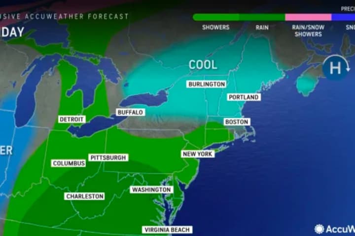
Timing On Powerful Storm Bringing Snow, High Winds To Much Of PA The National Weather Service has released an event summary of the powerful storm expected Sunday, Dec. 10. Heavy rain, damaging wind, and some snow is expected in parts of New Jersey and Pennsylvania beginning with rain mid-morning Sunday, Dec. 10. ⚠️🌧️🌬️🌨️ A strong storm system will impact our region beginning today through Monday. Heavy rain, strong winds, and some... Posted by US National Weather Service Philadelphia/Mount Holly on Sunday, December 10, 2023 We are anticipating strong winds & heavy rainfall in the northern parts of the state, starting Sunday afternoon and …
Snow Coming To PA In Powerful Weekend Storm (TIMING, UPDATES) Snow Coming To PA In Powerful Weekend Storm (TIMING, UPDATES)
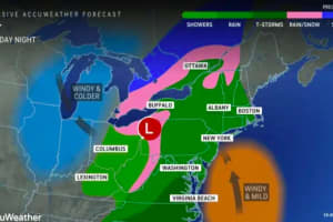
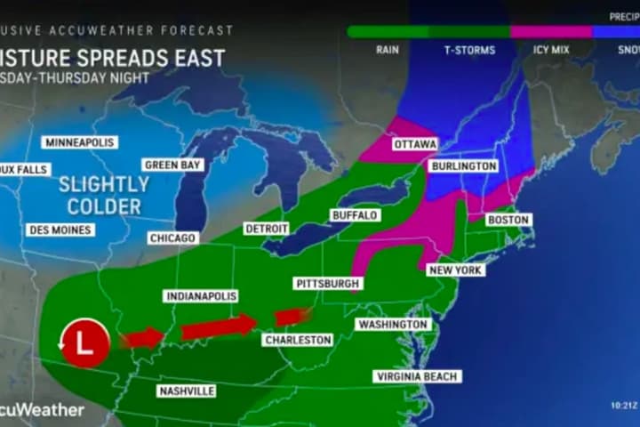
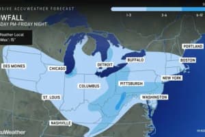
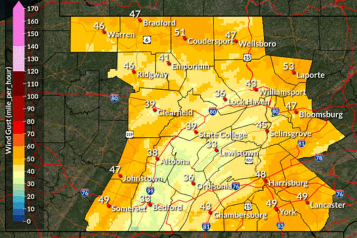
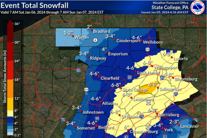
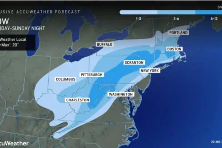
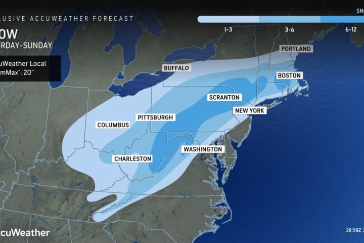
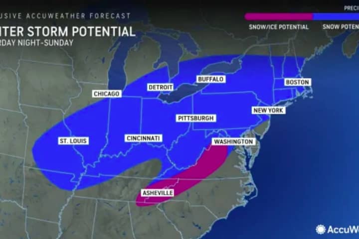
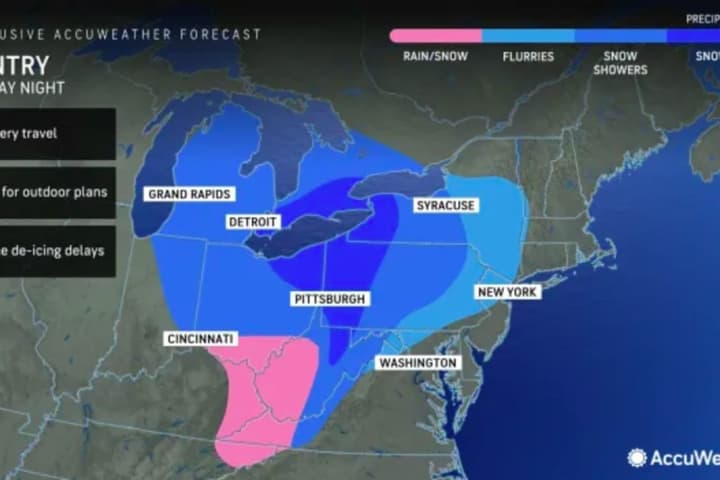
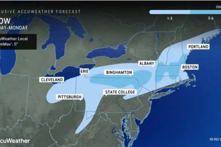
Snow Coming To PA In Powerful Weekend Storm (Timing, Updates) Several inches of snow could fall across parts of Pennsylvania in a powerful storm headed to the region this weekend. While the weekend will begin with a warmup with temps expected to reach 59 come Sunday, Dec. 10, a cold front isn't far behind. By Sunday night, temps will hit a low of 33. Rain and thunderstorms that will have begun in the morning will turn to snow in the northernmost swath of Pennsylvania and greater Pittsburgh (see weather map above). "One zone that has a higher chance of picking up 6 inches of snow during Sunday night is from north and east of Scranton, Pennsylvania to …
Wintry Mix To Become All Snow In Parts Of PA, MD: Here's The Timing Wintry Mix To Become All Snow In Parts Of PA, MD: Here's The Timing
Wintry Mix To Become All Snow In Parts Of PA, MD: Here's The Timing Wintry weather will become snow in parts of Pennsylvania and northern Maryland Tuesday, Dec. 5, the National Weather Service says. The Alberta Clipper formed in the Midwest on Monday, Dec. 4, and will exit over the mid-Atlantic on Tuesday night, Dec. 5, AccuWeather reports. According to the NWS' Pittsburgh station, a wintry mix is expected sometime later this morning and through the afternoon, before all precipitation turns to snow. The most likely areas for the mix would be south of I-80, while further south, say south of I-70, the precipitation may change to all rain for a time this afte…
Weekend Storms Bring Rain, Fog To Region Weekend Storms Bring Rain, Fog To Region
Weekend Storms Bring Rain, Fog To Region A pair of storms are expected to bring rain to the Northeast and mid-Atlantic this weekend. Friday afternoon and evening Dec. 1 will be drizzly with temps in the high 40s, according to the National Weather Service. Clouds thicken this morning. Rains arrive later this afternoon. High temperatures will be near normal for December 1. ☔️ Posted by US National Weather Service Philadelphia/Mount Holly on Friday, December 1, 2023 High temps today will be in the upper 40s to low 50s for most with rain already moving through the area. For this... Posted by US National Weather Service Ba…
Snow Showers Predicted In Parts Of PA: Here's The Timing Snow Showers Predicted In Parts Of PA: Here's The Timing
Snow Showers Predicted In Parts Of PA: Here's The Timing Snow could close out the month of November in parts of Pennsylvania, forecasters say. A chance of rain showers is predicted for Sunday, Nov. 26 in western PA and greater Pittsburgh, but temperatures are expected to plummet into the upper 30s on Monday, Nov. 26, according to the National Weather Service. Here's a look at the forecast highs and mins through next week. Rain returns late Sunday afternoon and spreads east over... Posted by US National Weather Service Pittsburgh PA on Saturday, November 25, 2023 There is a 60 percent of snow showers Monday morning, and a slight chance of sno…
Pre-Thanksgiving Storm To Cause 'Miserable' Travel Conditions: Here's The Latest Pre-Thanksgiving Storm To Cause 'Miserable' Travel Conditions: Here's The Latest
Pre-Thanksgiving Storm To Cause 'Miserable' Travel Conditions: Here's The Latest Forecasters are urging Thanksgiving travelers to allow for extra time in this year's trip due to a pre-Thanksgiving storm creeping in on the mid-Atlantic and Northeast. Up to three inches of rain are expected to fall along areas up and down the East Coast, beginning anywhere between 10 a.m. and 4 p.m. on Tuesday, Nov. 21, according to the National Weather Service.  Good evening! Overall, there hasn't been too much change with the forecast for the system still due to affect the area... Posted by US National Weather Service Philadelphia/Mount Holly on Monday, November 20, 2023 Temps will…
El Niño Now Forming Could Be 'Historically Strong': What It Means For Snowfall This Winter El Niño Now Forming Could Be 'Historically Strong': What It Means For Snowfall This Winter
El Niño Now Forming Could Be 'Historically Strong': What It Means For Snowfall This Winter An El Niño that is now forming could be "historically strong," according to forecasters. There is a 35 percent chance of it becoming "historically strong" for the November-January season, according to a brand-new update from the National Weather Service's Climate Prediction Center. El Niño events, which usually form every three to four years, are triggered by warmer surface water in the equatorial Pacific Ocean, with warmer water leading to stronger El Niños. The last time there was a "super" El Niño was 2015-2016. Traditionally, "super" El Niños have caused floods, fatal fires, and m…
Taurid Meteor Shower Peaks This Weekend: Best Places To See Falling Stars Taurid Meteor Shower Peaks This Weekend: Best Places To See Falling Stars
Taurid Meteor Shower Peaks This Weekend: Best Places To See Falling Stars If you're looking to wish upon a shooting star, this is the weekend to do it. The Northern Taurid — the second half of the Taurid Meteor Shower — peaks on Saturday, Nov. 11 and Sunday, Nov. 12, according to Space.com. "These showers produce infrequent, slow and long-lasting meteors associated with comet Encke, a small comet with a nucleus measuring approximately 2.98 miles (4.8 km) in diameter," the website says. Taurid meteors, or "Halloween Fireballs," are visible from anywhere on Earth, except for the South Pole.  "The best time to look for Taurids is after midnight, when Taurus i…
Snow Squalls Could Accompany Temp Drops In Parts Of Northeast: Forecasters Snow Squalls Could Accompany Temp Drops In Parts Of Northeast: Forecasters
Snow Squalls Could Accompany Temp Drops In Parts Of Northeast: Forecasters It's going down. The temperature, that is, as the risk of snow squalls in parts of the region goes up. Freeze warnings were issued by the National Weather Service in parts of New Jersey and the greater Philadelphia/Lehigh Valley Wednesday, Nov. 1. And another little post-Halloween treat is the possibility of snow squalls, according to AccuWeather. Snow squalls are a sudden moderate-to-heavy snowfall, usually accompanied by a sudden temperature drop making for dangerous conditions on roadways. ⚠️🧊 Widespread sub-freezing temperatures and frost development tonight will likely end the g…
Bone Chilling Halloween: Here's Your Trick-Or-Treating Forecast Bone Chilling Halloween: Here's Your Trick-Or-Treating Forecast
Bone Chilling Halloween: Here's Your Trick-Or-Treating Forecast You want spooky? Eighty degrees this week, below 40 next. While this weekend is set to feel like summer, forecasters are warning residents in the Northeast of a chilly Halloween night. Saturday, Oct. 28 is expected to be an idyllic beach day, with sunny skies and highs near 80. Temps will be around 50 at night, according to AccuWeather. Sunday is calling for rain showers in the afternoon with a high close to 60. A significant cool-down is expected to set in early next week: Monday, Oct. 30 will be cloudy then rainy with a high close to 60, while Tuesday, Oct. 31 will be sunny wit…
'Temperature Turnaround:' Unseasonably Warm Weather Coming To Northeast 'Temperature Turnaround:' Unseasonably Warm Weather Coming To Northeast
'Temperature Turnaround:' Unseasonably Warm Weather Coming To Northeast Mother Nature isn't ready for winter yet — or fall, for that matter. While this week got off to a chilly start in the Northeast, the finish will be anything but, forecaster say. Tuesday, Oct. 24, and Wednesday, Oct. 25 will be sunny with temps in the high 60s, Thursday, Friday, and Saturday will reach highs around 75. In Philadelphia, Washington DC, and Baltimore, temperatures could climb as high as 80, AccuWeather says, calling it a "temperature turnaround." The forecast low tonight in Philly is 40°. The last time the low was 40° or less in Philly this year was April 10, when... Pos…
Winter 2023-24 Forecast Released By NOAA National Weather Service Winter 2023-24 Forecast Released By NOAA National Weather Service
Winter 2023-24 Forecast Released By NOAA National Weather Service The National Oceanic and Atmospheric Administration's National Weather Service has just released its outlook for the winter of 2023-24.El Niño is in place heading into winter for the first time in four years, driving the outlook for warmer-than-average temperatures for the northern tier of the continental United States, according to NOAA’s US. Winter Outlook, which was released on Thursday, Oct. 19 by NOAA's Climate Prediction Center — a division of the National Weather Service.  At the same time, the forecast says much of the Northeast has a 40 to 50 percent chance of above-normal…
Potential 'Full-Fledged' Nor'easter Could Hit Region: Here's What Forecasters Are Saying Now Potential 'Full-Fledged' Nor'easter Could Hit Region: Here's What Forecasters Are Saying Now
Potential 'Full-Fledged' Nor'easter Could Hit Region: Here's What Forecasters Are Saying Now One day of each weekend in the last six weeks has seen rain or showers. Get ready to make it seven in a row. But this weekend, that stormy pattern may kick it up a notch. Click here for a new, updated story: Chances Increase For Nor'easter Packed With Soaking Rain, Strong Winds: Here's Latest That's because forecasters are eyeing the chance for a significant storm along the East Coast that has the potential to become "a full-fledged Nor’easter, which will bring soaking rain and strong winds," according to AccuWeather.com. The current projected possible time frame for the storm is …
Two Inches Of Rain To Drench Northeast This Weekend: Here's Timing Two Inches Of Rain To Drench Northeast This Weekend: Here's Timing
Two Inches Of Rain To Drench Northeast This Weekend: Here's Timing The Northeast is in for another rainy weekend. While skies on Friday, Oct. 13 were sunny and temps were pleasant, Saturday, Oct. 14 was expected to come with rain for the Northeast: Nearly two inches of it, according to AccuWeather. New Jersey, Maryland, Pennsylvania and Virginia will get drenched, with rainfall expected to begin in the early afternoon, as reported by AccuWeather and the National Weather Service. 🌤️ Happy Friday the 13th! Nothing scary about today's forecast. Another pleasant and sunny day before clouds and rain... Posted by US National Weather Service Philadelphia/Mo…
Storm System Heads Toward Region: Another Rainy Weekend Ahead Storm System Heads Toward Region: Another Rainy Weekend Ahead
Storm System Heads Toward Region: Another Rainy Weekend Ahead Seems as though we can't go a single weekend without rain in the Northeast this fall. Another developing storm system is expected to arrive this Saturday, Oct. 14, according to the National Weather Service. "Several days of quiet weather are expected before a storm system arrives unfortunately in time for the weekend," the NWS' Mount Holly office said. "Mild temperatures are expected overall, though it will likely be cold enough for frost around the Shenandoah Valley tonight," the Baltimore/DC NWS office said.  "The next chance of rain comes heading into this weekend." Tuesday, Oct.…
Cold Front Coming: Rainy Days Will Be Followed By Fall Temps Finally Cold Front Coming: Rainy Days Will Be Followed By Fall Temps Finally
Cold Front Coming: Rainy Days Will Be Followed By Fall Temps Finally After a day or two of rain, the weather will be feeling a lot more like fall here in the Northeast, meteorologists are saying. The temps this last week have hovered somewhere around 80 with sunny skies, but that's going to change by Sunday, Oct. 8, forecasters say.  While Friday, Oct. 6 will be cloudy with patchy fog and a high near 75, a temperature change is expected overnight into Saturday, Oct. 7, as a cold front sweeps through the region, the National Weather Service says. Showers will develop Friday into Saturday before the weather turns windy and cooler.  As the rain clears, the t…
'Get Your Snow Shovels Ready': AccuWeather Releases Winter Outlook 'Get Your Snow Shovels Ready': AccuWeather Releases Winter Outlook
'Get Your Snow Shovels Ready': AccuWeather Releases Winter Outlook Forecasters for AccuWeather have released their projections for the winter of 2023-24. Senior Meteorologist Paul Pastelok and his team are saying it's shaping up to be much different than last winter, especially across the central and eastern United States, and one month may leave the biggest impression. "February can be an active and intense month," Pastelok said. One of the driving forces this winter will be the strengthening El Niño, which will play a significant role in the weather across the United States throughout the entire winter season.  Earlier report - 'Super'…
Unseasonably Warm Start To Spooky Season Expected Across East Coast Unseasonably Warm Start To Spooky Season Expected Across East Coast
Unseasonably Warm Start To Spooky Season Expected Across East Coast We're going from one wacky weather pattern to another this weekend. The East Coast has one more day of cloudy skies and patchy fog before the weather pattern changes again. Saturday, Sept. 30 will be cloudy but warm, with temps in the low 70s, but Sunday, Oct. 1 will be sunny and even warmer, beginning a stretch of summer-like days, AccuWeather says. Temps are expected to reach the low 80s in the DMV come Tuesday, which would be about 8 degrees above the historical average, the outlet says. The weather might even be nice enough for a beach day, but forecasters urge caution, as rough s…
'Super' El Niño Could Be Forming: What It Means For Snowfall, Temperatures This Winter 'Super' El Niño Could Be Forming: What It Means For Snowfall, Temperatures This Winter
'Super' El Niño Could Be Forming: What It Means For Snowfall, Temperatures This Winter The presence of El Niño this winter will have a significant impact on the type and frequency of weather to expect, according to the National Oceanic and Atmospheric Administration (NOAA). El Niño events, which usually form every three to four years, are triggered by warmer surface water in the equatorial Pacific Ocean, with warmer water leading to stronger El Niños. In a report released this week, NOAA said "El Niño is anticipated to continue through the Northern Hemisphere winter," with a greater than 95 percent chance through January-March 2024. There's a 30-percent chance, accordin…
Tropical Storm To Bring Drenching Downpours, Gusty Winds To East Coast (TIMING) Tropical Storm To Bring Drenching Downpours, Gusty Winds To East Coast (TIMING)
Tropical Storm To Bring Drenching Downpours, Gusty Winds To East Coast (Timing) We're in for a rainy one. A tropical storm expected to make landfall this weekend in North Carolina will bring heavy rain and gusty winds to the East Coast. The storm, which is expected to make landfall in North Carolina Saturday, Sept. 23, is largely expected to hug the mid-Atlantic coast, but one scenario has it "hooking to the left and over eastern Virginia or the Delmarva Peninsula," AccuWeather says. Several outdoor events had already been canceled Friday morning, Sept. 22, in anticipation of torrential rain on Saturday and Sunday. Storm pathAccuWeather Strong gusty winds are…
Hurricane Lee Won't Have Much Impact On PA, Weather Maps Show Hurricane Lee Won't Have Much Impact On PA, Weather Maps Show
Hurricane Lee Won't Have Much Impact On PA, Weather Maps Show Hurricane Lee is expected to make landfall in Canada sometime over the weekend. What does that mean for New Jersey, Pennsylvania, and the mid-Atlantic states? Not a lot. ...TROPICAL STORM CONDITIONS EXPECTED ON BERMUDA BEGINNING EARLY TOMORROW... ...RISK OF WIND, COASTAL FLOODING, AND... Posted by NOAA NWS National Hurricane Center on Wednesday, September 13, 2023 Lee's most-likely course shows it will make landfall in Atlantic Canada at the end of the week, and its most significant impacts will be felt in Halifax and some of New England. In New Jersey, Pennsylvania, and the mid-Atla…
Hurricane Lee Growing Larger Before Expected Northward Turn: Latest Projected Landfall Timing Hurricane Lee Growing Larger Before Expected Northward Turn: Latest Projected Landfall Timing
Hurricane Lee Growing Larger Before Expected Northward Turn: Latest Projected Landfall Timing Hurricane Lee is growing in size before it is expected to take a sharp northerly turn by midweek. Click here for a new, updated story: Hurricane Lee Track Shift Poses Increased Threat For Northeast, Possible New England Landfall As of around 11 a.m. Tuesday, Sept. 12, Lee is located about 550 miles south of Bermuda with 115 mile-per-hour winds. A Category 3 storm on the Saffir-Simpson Hurricane Wind Scale, it's moving northwest at 6 miles per hour, the National Hurricane Center said. Hurricane-force winds now extend 90 miles from Lee’s center, an increase from the weekend. Some slowing…
Hurricane Lee Restrengthens: New Models Predict Timing, Expected Site Of Landfall Hurricane Lee Restrengthens: New Models Predict Timing, Expected Site Of Landfall
Hurricane Lee Restrengthens: New Models Predict Timing, Expected Site Of Landfall Hurricane Lee has restrengthened as it is just days away from affecting a massive stretch of coastline along the East Coast. Click here for the latest update - Here Comes Hurricane Lee: Watches, Advisories Stretch From NY Through New England As of early Monday morning, Sept. 11, Lee is located 340 miles north of the Leeward Islands in the Caribbean with 120 mile-per-hour winds. Now a Category 3 storm, it's moving northwest at 7 miles per hour, the National Hurricane Center said. It could briefly return to Category 4 status Tuesday morning, Sept. 12 before returning to Category 2 sta…
Hurricane Lee's Risk To East Coast Rises: New Week-Long Projected Track Hurricane Lee's Risk To East Coast Rises: New Week-Long Projected Track
Hurricane Lee's Risk To East Coast Rises: New Week-Long Projected Track A new week-long projected track for Monster Hurricane Lee has been released as forecasters are now saying its risk to the East Coast has increased. "Hurricane Lee will remain a powerful storm after undergoing rapid intensification," according to a report by AccuWeather.com on Saturday, Sept. 8. "As Lee turns northward next week dangerous surf will develop along the East Coast while the risk for direct impact rises in New England." For a look at Lee's projected path through Saturday, Sept. 16, see the image above. Lee is now a Category 3 hurricane packed with maximum sustained winds of…
New Monster Storm Update: Forecast Models Take Major Hurricane Lee Along East Coast New Monster Storm Update: Forecast Models Take Major Hurricane Lee Along East Coast
New Monster Storm Update: Forecast Models Take Major Hurricane Lee Along East Coast Hurricane Lee has rapidly strengthened with new long-range computer models predicting its eventual path could take it at or near the Northeast. Click here for a new, updated story: Hurricane Lee's Risk To East Coast Rises: New Week-Long Projected Track Lee, now packed with maximum sustained winds of 150 miles per hour, is located over the warm waters of the Central Atlantic, hitting Category 5 status before wind speeds lowered it to Cat 4. It's expected to move over the Virgin Islands and Puerto Rico this weekend, according to the National Hurricane Center. Already the st…
'Exceptionally Dangerous Weather Event': Lee Becomes Powerful Hurricane, May Hit Cat 5 In Days 'Exceptionally Dangerous Weather Event': Lee Becomes Powerful Hurricane, May Hit Cat 5 In Days
'Exceptionally Dangerous Weather Event': Lee Becomes Powerful Hurricane, May Hit Cat 5 In Days Tropical Storm Lee has strengthened to a hurricane earlier than expected with its current path taking it toward the Atlantic Coast, possibly reaching Category 5 status. Lee, located in the Central Atlantic, is now packed with 110 mile-per-hour winds, making it a Category 2 hurricane, according to the National Hurricane Center. "A more significant threat from Hurricane Lee to the US East Coast could unfold during the middle or end of next week if the storm turns toward the coast," according to AccuWeather.com. Lee is expected to continue strengthening over the next couple of days, beco…
Severe Thunderstorm Watch In Effect For Much Of Region Severe Thunderstorm Watch In Effect For Much Of Region
Severe Thunderstorm Watch In Effect For Much Of Region With a round of storms moving from west to east in interior portions of the region, a Severe Thunderstorm Watch has been issued for much of the area The watch is in effect until 9 p.m. Thursday, Sept. 7 across DC, MD, NJ, PA, and VA. Potentially dangerous straight-line wind gusts are the primary threat, with potentially damaging hail also possible, according to the National Weather Service. Localized heavy rainfall and lightning are also possible. The storms are expected to break the extreme heat, but could stick around until Tuesday, Sept. 12, AccuWeather says. Thunderstorms to break…
Here's Timing On Separate Rounds Of Storms That Will Bring Relief From Heat Here's Timing On Separate Rounds Of Storms That Will Bring Relief From Heat
Here's Timing On Separate Rounds Of Storms That Will Bring Relief From Heat A days-long stretch of hot and humid conditions will finally come to an end with the arrival of an unsettled weather pattern that will include separate rounds of storms. The high temperature on Thursday, Sept. 7 will generally be in the low 90s with the heat index in the upper 90s due to high humidity, according to the National Weather Service. A Heat Advisory is in effect for most of the region until early Thursday evening. Clouds will increase Thursday night as the unsettled conditions arrive, prompting the separate storm chances. The first chance for showers and thun…
Heat Relief? Here's When Cool-Down Is Expected For Northeast Heat Relief? Here's When Cool-Down Is Expected For Northeast
Heat Relief? Here's When Cool-Down Is Expected For Northeast Summer is holding on for dear life in the Northeast.  We're in the midst of the hottest stretch of the past few months with real-feel temps expected to near 100 degrees across parts of the East Coast this week. Don't give up on fall weather yet, relief is just days away, forecasters say. Temps averaged 95 degrees on Labor Day and Tuesday, Sept. 5, and it weren't expected to be much better Wednesday, Sept. 6: AccuWeather's real-feel map shows much of the mid-Atlantic could seem like temperatures are more than 100 degrees. ALSO SEE: Extreme Heat Causes Schedule Changes For These NJ Distric…
New Tropical System Expected To Become Major Hurricane Threatens East Coast New Tropical System Expected To Become Major Hurricane Threatens East Coast
New Tropical System Expected To Become Major Hurricane Threatens East Coast A new tropical system has developed and is expected to become a major hurricane threatening the East Coast by this weekend. Tropical Depression 13, now in the Central Atlantic is headed on a northwestern path, the National Hurricane Center said. The storm is expected to create "stronger surf and rip currents" along the Eastern Seaboard, from Florida to Maine, AccuWeather said. Depending on the path it takes, the expected time frame for potential impacts to the United States and Atlantic Canada is from Wednesday, Sept. 13 through Saturday, Sept. 16, possibly as a Category 4 hurricane, …
Blazing Fireball Meteor That Became Disintegrated Over Pennsylvania Captured In Stunning Photos Blazing Fireball Meteor That Became Disintegrated Over Pennsylvania Captured In Stunning Photos
Blazing Fireball Meteor That Became Disintegrated Over Pennsylvania Captured In Stunning Photos A New Jersey photographer happened to have his camera ready as a fireball meteor dashed across the mid-Atlantic Sunday, Sept. 3. Werner Tedesco was taking photos in a sunflower field facing west along Route 47 in Goshen (Middle Township, Cape May County), when the fireball meteor came streaking across the sky just after 9:15 p.m. New Jersey's Werner Tedesco captured the fireball that lit up the mid-Atlantic Sunday, Sept. 3.Werner Tedesco "I watched it go from almost directly above me to right over the Delaware Bay," Tedesco said in a Facebook post. "It was VERY bright and green in color…