Rain will move in to the state from the west on Tuesday night and continue through the day on Wednesday, the NWS says.
When temps drop Wednesday night, the rain may mix with or change to a period of snow across the higher terrain of Northern and Western PA, according to the NWS.
Just more than a week into spring and Pennsylvania has had several sunshiny and breezy days, but the NWS says the mild weather will shift to "A lionish end to March and an unseasonably cold, foolish start to April."The snow may have a few inches of accumulation in higher elevations.
The mix of winter precipitation into snow could even led to accumulations in lower elevations with wet snow at high fall rates.
"As the cold northwestern flow deepens, expect lake enhanced snow showers over the Allegheny Plateau Thursday into Thursday night before tapering off into early Friday," the NWS specifically state says.
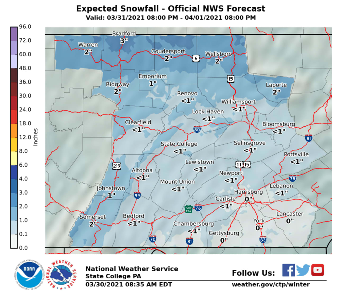
"Total snowfall Wednesday night through Thursday ranges from 1-3" over the Laurel Highlands and northern Alleghenies to <1 inch between the I-99/US-220 and I-81 corridor. Little to no accumulation is forecast along and south of US-30."
The rest of the week is expected to stay cold, with below normal temperatures with wind gusts adding to the chill.
Easter Sunday we'll see a return to moderate temperatures and dry, breezy days.Click here to follow Daily Voice Berks and receive free news updates.