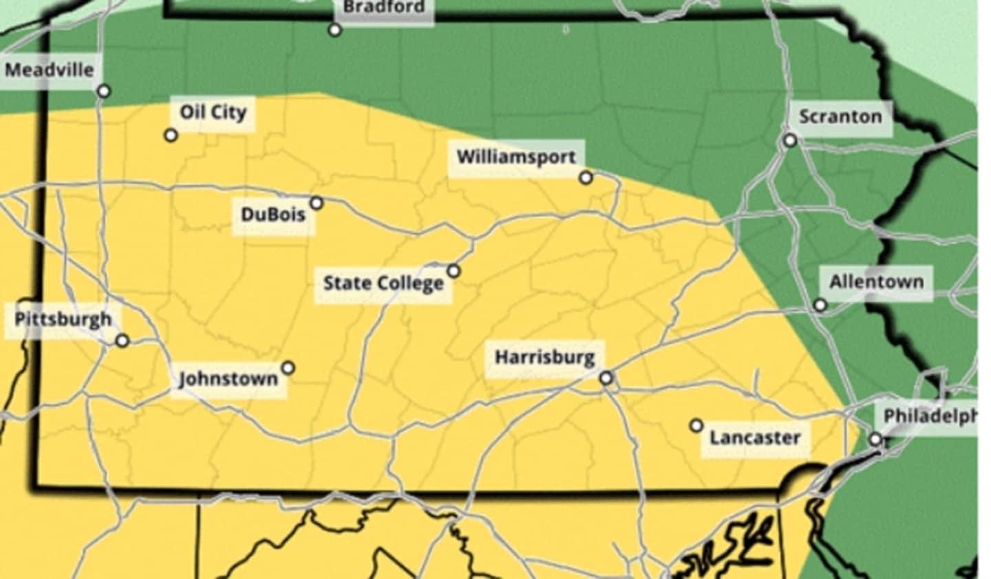
"Damaging large hail", "large wind gusts", and fast-moving thunderstorms may hit homes in Pennsylvania, throughout the day but are expected to be at their worst after 2 p.m., the NWS forecasts.
The Doppler radar indicts more heavy rain will arrive with the thunderstorms this afternoon, in addition to the rain that have already fallen in the morning, according to the outlet. Due to this, minor flooding is ongoing and expected to begin shortly across portions of the advisory area shown in the map pictured.
Portions of Virginia and Maryland — may experience similar storms but Pennsylvania will receive the bulk of the rain; although forecasters at both AccuWeather and NWS are advising residents throughout the region to stay alert potential flash flooding.
The areas with the most severe risk of storm damage is south central Pennsylvania.
Scattered showers remain possible for the rest of the week, especially Friday, but even though there is still a chance of a shower on Saturday, driver air is expected over the weekend.
Follow Daily Voice for more weather updates.
Click here to follow Daily Voice Adams and receive free news updates.