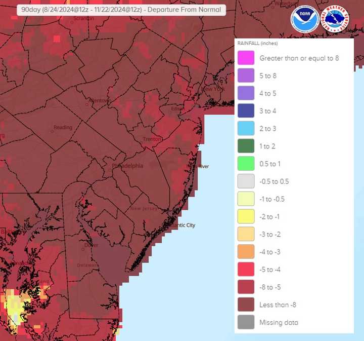
As of Thursday, November 21, extreme drought (D3 classification) covers 36% of the region—the highest extent since August 2002. Portions of Delmarva and the Philadelphia suburbs are among the hardest-hit areas, with deficits exceeding 5 to 9 inches over the past 90 days, according to the NWS.
Recent rainfall offered slight relief, significantly reducing fire danger across the region, but it won’t be enough to eliminate the drought. "We still need several more inches of rain to make any meaningful progress on eliminating the drought," the NWS said Saturday.
The drought follows months of record-low precipitation levels. Year-to-date rainfall deficits range from 3 to 5 inches in most areas, with localized spots faring better or worse.
Another shot of light rain is expected Monday night into Tuesday morning, but no significant improvement to the drought is anticipated. A coastal storm system is being monitored for Thanksgiving into Friday, though its potential impacts remain uncertain, forecasters said.
In the meantime, residents are urged to secure loose objects and decorations as breezy conditions are forecasted for Saturday, Sunday, and Tuesday.
With fire risk reduced, attention now turns to how much longer the drought will last. For more updates and weather alerts, visit the National Weather Service website.
Click here to follow Daily Voice Wayne-Radnor and receive free news updates.
