On Friday, Jan. 5, the National Weather Service released a new model showing between eight and 12 inches of snow in Sussex and Warren counties in New Jersey, and the Pocono mountains in PA (scroll for map).
The chance of snow isn't looking good for greater Philadelphia this weekend, the NWS says, noting snow-lovers in the area will be "disappointed" by this weekend's system.
"Our latest forecast has only a 3% chance of seeing 1" or more of snowfall. So the snow drought should continue," the NWS said. "There will be some wet snow to start, but not enough for an inch."
The chance of snow in western Pennsylvania, however, is much greater, the NWS said.
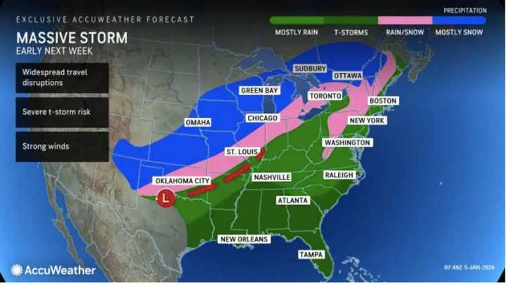
Another storm coming Tuesday, Jan. 9 and Wednesday, Jan. 10 is expected to bring 2 to 3 inches of rain to the region, according to the NWS.
The melting snow combined with the new rainfall could lead to excessive flooding, meteorologists warn.
Strong to locally damaging winds are possible which may result in downed trees and power lines and power outages, the NWS said in its latest briefing.
The most significant impacts are expected late Tuesday, Jan. 9, the NWS says. However, it's still too soon to know the exact timing.
AccuWeather released a map depicting next week's precipitation (see above).
Click here to follow Daily Voice Reading and receive free news updates.
