Thursday, March 7 will be be mild with scattered showers while Friday, March 8 will be mostly sunny with temps in the mid-50s, forecasters say.
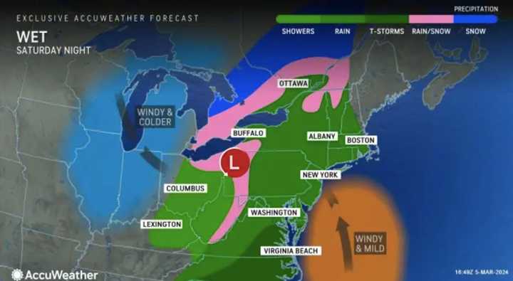
Saturday, March 9 is when the new storm will begin moving into the region with rain beginning in the afternoon and lasting overnight, according to the National Weather Service.
About an inch of rain is expected to fall, which the National Weather Service says isn't much, but given an already-wet ground "there is potential for minor flooding on some rivers and streams."
On Saturday night, "drenching rain may be accompanied by thunderstorms that can advance northeastward from the mid-Atlantic into southern New England, raising concerns for urban and small stream flooding and leading rises along some area rivers," AccuWeather says.
Parts of western Pennsylvania could see some snow into Sunday, AccuWeather says.
AccuWeather Meteorologist Joseph Bauer says the first part of the weekend could feel "more like early April rather than March," but Sunday into Monday could feel like February again with colder air and wind gusts up to 50 mph.
"Accuweather RealFeel® Temperatures will dip into the single digits and teens over the interior Northeast and the 20s to 30s in the mid-Atlantic coastal areas," the weather outlet said.
The National Weather Service predicts minor coastal flooding through the end of the week.
Click here for more from AccuWeather.
Click here to follow Daily Voice Lower Merion-Narberth and receive free news updates.


