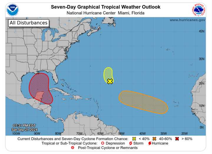
According to the National Hurricane Center, it is now located in the Gulf of Mexico, projected to move toward the US coast, and has a 70 percent chance of cyclone development.
According to the latest European forecast model, it will become a Category 1 hurricane and make landfall at daybreak on Saturday, Sept. 28, in the Big Bend region of Florida.
"The eventual path of the potential tropical storm is dependent on the strength of the jet stream over the US," said AccuWeather Meteorologist Mike Youman. "A weaker jet stream would likely result in a slower, farther west movement of the storm toward Mexico and the western Gulf of Mexico, while a stronger jet stream would portend a faster movement of the storm farther east toward Cuba, the eastern Gulf or Florida."
Another system in the northwestern Caribbean Sea a few hundred miles southeast of Bermuda has not yet become organized.
Helene will be the name of the next tropical storm during the 2024 hurricane season, which runs through Saturday, Nov. 30.
Check back to Daily Voice for updates.
Click here to follow Daily Voice West Islip and receive free news updates.
