Accumulation totals for the midweek storm, the second of two systems that will sweep through the region in the coming days, have now been released.
That time frame for that system is early Wednesday morning, Dec. 8, into Wednesday evening.
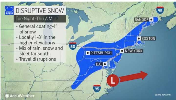
Most of the region is expected to generally see a coating to 1 inch of snowfall, with locally higher totals of 1 to 3 inches possible in higher elevations. (See the first image above.)
There is still some uncertainty surrounding the storm's track, so there is a chance those projections could change prior to Wednesday.
But before that system sweeps through, another storm bringing rain, showers, and strong wind with gusts up to 50 miles per hour will be followed by a sharp drop in temperatures, setting the stage for the potential for the midweek storm being a snowmaker.
That first storm, a frontal system, arrived Monday morning, Dec. 6. Rainfall from the initial part of the system will taper off in the middle of the morning. Skies will remain cloudy throughout the day, with a brief rise in temperatures, with the high reaching the upper 50s.
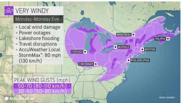
The second round of the storm will come just after nightfall on Monday. Along with rain and showers, most of the region will see 30 to 50 mph wind gusts on Monday (light purple in the second image above) with 50 to 70 mph gusts in some spots (dark purple), according to AccuWeather. Scattered power outages are possible.
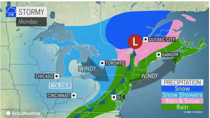
Precipitation from that storm will mainly be rain (in green in the third image above).
Scattered showers are expected to linger through the early overnight hours on Tuesday, Dec. 7.
Skies will then clear on Tuesday as temperatures plummet, with a high of only about 40 degrees on a mostly sunny day. For Tuesday's temperatures with the wind-chill factor, click on the fourth image.
Check back to Daily Voice for updates.
Click here to follow Daily Voice New City and receive free news updates.


