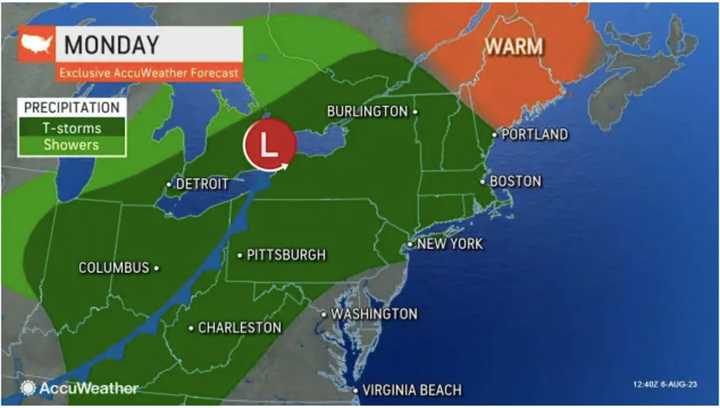
Storm activity will continue at times throughout the day on Monday, Aug. 7 into Tuesday, Aug. 8.
A brief tornado is possible, the weather service noted in a Hazardous Weather Outlook statement issued early Monday morning.
"Excessive runoff may result in flashier small streams, rivers, and creeks rising out of their banks," the National Weather Service said.
Widespread rainfall amounts of around 2 inches are expected with localized higher amounts up to around 3 or 4 inches possible, with some hourly rainfall rates of 1 to 2 inches possible.
There is uncertainty surrounding "the exact timing and location of the heaviest rainfall, which could enhance amounts and flooding," according to the weather service.
Scattered showers and storms will continue at times Tuesday before gradually winding down from west to east.
Monday's high temperature will be in the mid-70s and in the upper 70s on Tuesday.
The outlook for Wednesday, Aug. 9 calls for sunny skies and a high temperature in. themid-80s.
Check back to Daily Voice for updates.
Click here to follow Daily Voice Massapequa and receive free news updates.
