A radar image of the region from the National Weather Service before 7:30 a.m. shows the most potent storms marked in red) severe. They've been accompanied by heavy downpours, lightning, and thunder.
Most parts of the Northeast will see a break in the activity from mid-morning through the early afternoon before another batch of storms moves in during the late afternoon, lasting into the evening.
Temperatures will top out in the upper 80s on Saturday, but humidity levels as high as 100 percent will make it feel like it's in the upper 90s.
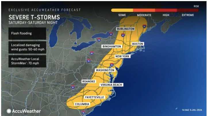
The second image above from AccuWeather.com shows areas most likely to see more severe storms late in the day and evening on Saturday.
The strongest storms are expected early Saturday evening.
After patchy morning fog on Sunday morning, July 7, skies will become partly to mostly sunny. It will remain humid with a high temperature of around 90 degrees and heat index values in the mid to upper 90s.
Monday, July 8, will be less humid, but the mercury is expected to once again hit 90 degrees.
It will be partly sunny most of the day on Tuesday, July 9 with temperatures in the upper 80s. A return of humid air will lead to a chance of late afternoon and evening showers and thunderstorms.
The outlook for Wednesday, July 10 calls for mostly cloudy skies, high temperatures in the upper 80s, and another chance for afternoon and evening storms.
Check back to Daily Voice for updates.
Click here to follow Daily Voice Massapequa and receive free news updates.

