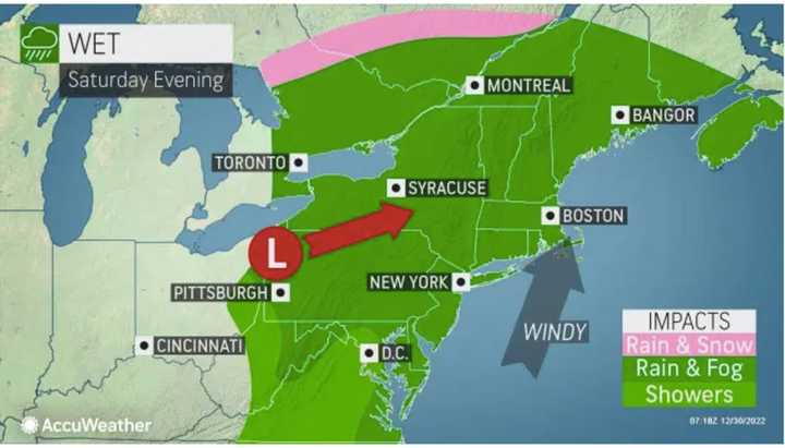
The fast-moving rainmaker will arrive in the afternoon on New Year's Eve day on Saturday, Dec. 31, as a frontal system will trigger the system, the National Weather Service said. (See the first image above.)
Wet roads and low visibility can pose some problems for motorists and airlines on Saturday as the storm's reach will extend up and down the East Coast, according to AccuWeather.com. (Click on the second image above.)
Snow is not expected since temperatures should be well above freezing. In fact, current projections have the temperature in Manhattan for the ball drop in Times Square at about 50 degrees.
Precipitation is expected to arrive early Saturday afternoon followed by rain and more showers at times, with areas of fog during the day and night on New Year's Eve day.
Showers are then expected to linger into the morning on New Year's Day, Sunday, Jan. 1 with more areas of fog, followed by partly sunny skies and a high temperature in the low to mid 50s.
Friday, Dec. 30 will be mainly sunny with a high temperature in the low 50s, about 10 to 15 degrees above average with mostly sunny skies during the day, according. to the National Weather Service.
There will be increasing clouds Friday night ahead of the arrival of the New Year's Eve storm.
Saturday's temperature should hold steady in the 50- to 55-degree range during the day, and drop only a few degrees overnight.
Check back to Daily Voice for updates.
Click here to follow Daily Voice Hudson and receive free news updates.

