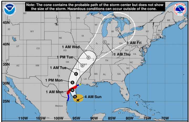
According to the National Hurricane Center, Tropical Storm Beryl, which is now churning in the Gulf of Mexico, is predicted to make landfall in south Texas as a hurricane on Monday morning, July 8.
Beryl strengthened to Category 5 hurricane status last week before making its first landfall—over the island of Carriacou in Grenada.
"Beryl could stall over Texas, which may result in excessive rainfall and widespread, major flooding in some areas early week," AccuWeather says.
Some parts of Texas could see as much as 15 inches of rainfall from Beryl starting Sunday, July 7, and lasting through midweek, according to forecasters.
"Beryl is forecast to bring damaging hurricane-force winds to portions of the lower and middle Texas coast late Sunday night and Monday," the National Hurricane Center said, saying that tropical storm conditions are expected to arrive in Texas Sunday night.
After making landfall, Beryl is expected to track north-northeast. (See the first image above.)
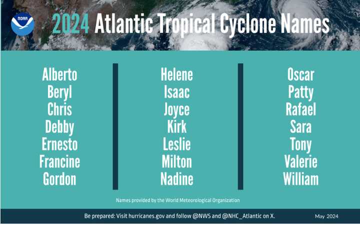
For timing during its path, click on the second image above.
National Oceanic and Atmospheric Administration (NOAA) forecasters are predicting 17 to 25 named storms (winds of 39 miles per hour or higher) this year. That's the most storms ever predicted for an Atlantic hurricane season.
Of those, eight to 13 are forecast to become hurricanes (winds of 74 mph or higher), including four to seven major hurricanes (category 3, 4, or 5, with winds of 111 mph or higher).
According to NOAA, the upcoming Atlantic hurricane season is expected to be very active. This is due to several factors.
These factors include near-record warm ocean temperatures in the Atlantic Ocean, the development of La Niña conditions in the Pacific, reduced Atlantic trade winds, and less wind shear. All of these conditions tend to favor the formation of tropical storms.
The 2024 Atlantic hurricane season runs from Saturday, June 1 to Saturday, Nov. 30.
Check back to Daily Voice for updates.
Click here to follow Daily Voice Freeport and receive free news updates.


