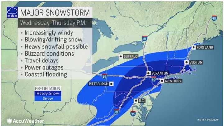
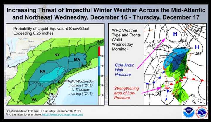
The time frame for the storm is late Wednesday afternoon, Dec. 16 into early Thursday morning, Dec. 17.
"There is increasing potential for a significant winter storm Wednesday afternoon into Thursday morning with heavy snow, strong winds, and coastal flooding," the National Weather Service said in a Hazardous Weather Outlook statement issued early Monday morning, Dec. 14.
The potential blockbuster storm is due to arrive after a mix of snow and rain at times on Monday with an inch or so of accumulation in much of the region and a mostly sunny day Tuesday, Dec. 15 with a high temperature in the upper 30s and wind-chill factor between 20 and 30 degrees.
If the storm develops to its potential, a foot or more of snowfall accumulation is possible in much of the area, according to both the National Weather Service and AccuWeather, with most of the region seeing between 6 and 11 inches of accumulation, with the potential for maximum totals of 12 to 18 inches in areas seeing the heaviest snowfall.
In those areas, blizzard conditions are possible at times, with strong winds, blowing and drifting snow, and scattered power outages. (See the first two images above.)
"While we continue to monitor trends, residents in the East need to pay close attention to the forecast over the next few days," AccuWeather Senior Meteorologist Tyler Roys said. "This storm has the potential to be highly disruptive for a large number of people."
Snowfall should start right around nightfall on Wednesday and continue into late Thursday morning, based on the current models.
There still remains uncertainty surrounding the track and strength of the storm, and snowfall projections will likely be adjusted as the storm nears.
This continues to be a developing story. Check back to Daily Voice for updates.
Click here to follow Daily Voice Brentwood and receive free news updates.


