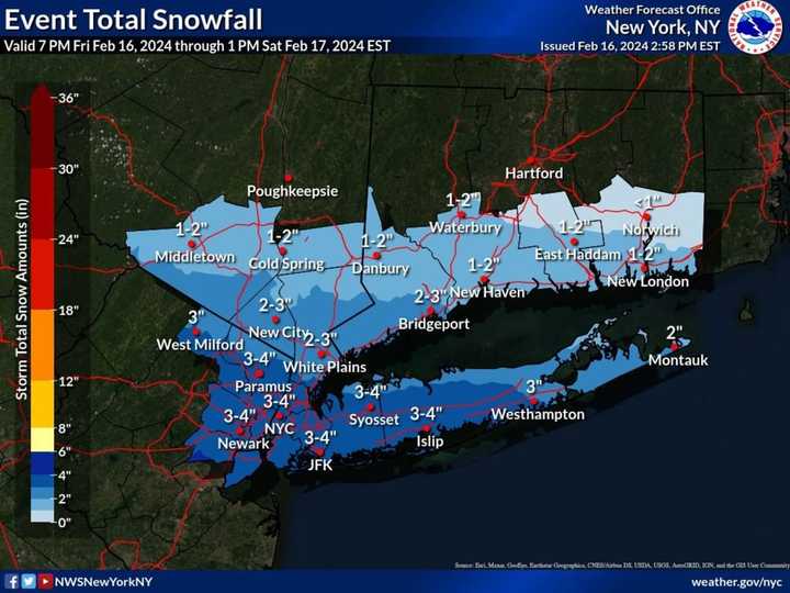
The system arrived overnight Friday, Feb. 16, and is expected to continue into early Saturday afternoon, Feb. 17.
In a new forecast map released by the National Weather Service, as much as 4 inches of accumulation is now forecast for parts of the area shown in the darkest shade of blue in the image above, including much of Long Island. Locally higher amounts of up to 5 inches are possible.
Parts of Westchester, Fairfield, Rockland, and Orange counties and the rest of Long Island could get around 3 inches of accumulation.
In those parts of the region, slippery travel conditions are being reported on Saturday morning
After the system pushes through, there will be gradual clearing on Saturday afternoon as the high temperature reaches the mid-30s.
That will lead to a mostly sunny day Sunday, Feb. 18 with temperatures in the mid-30s.
Presidents' Day on Monday, Feb. 19 will be sunny with a high in the low 40s.
The outlook for Tuesday, Feb. 20 calls for mostly sunny skies with a high temperature in the upper 30s to low 40s.
Check back toDaily Voice for updates.
Click here to follow Daily Voice Brentwood and receive free news updates.
