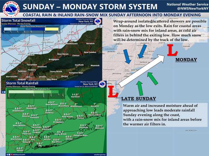
The storm is expected to move from the south to the north starting late in the afternoon on Sunday, Jan. 22, and continue into the overnight through Monday morning, Jan. 23, according to the National Weather Service.
Anywhere from 3 to 8 inches of snowfall accumulation is possible in the areas shown in the first image above.
Areas farther south expected to see a trace or more of snow are shown in the second image above, in the upper left corner.
The storm is expected to wind down late in the morning or around midday on Monday, with skies gradually clearing on a brisk and breezy day with a high temperature in the upper 30s to low 40s.
It will be the first of two storms in a matter of days, with another system also bringing a mix of rain, sleet, and snow due to arrive Wednesday afternoon, Jan. 25.
This continues to be a developing story. Check back to Daily Voice for updates.
Click here to follow Daily Voice Beekman-Poughquag and receive free news updates.

