"The storm is a marathon, not a sprint," AccuWeather Senior On-Air Meteorologist Justin Povick said of the 48-hour storm that began Wednesday in the central part of the US.
Save for parts of Morris, Sussex, and Warren counties, New Jersey will see mostly rain Thursday night into the late morning or early afternoon Friday, the National Weather Service says. There is a chance it will turn to freezing rain or create ice on the ground as temps start to drop.
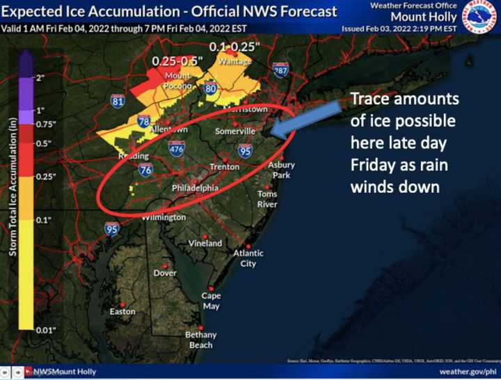
The greatest ice amounts are expected in the Poconos and in far northern New Jersey between 1 a.m. and 7 p.m. Friday, the NWS says (see photo above). Trace amounts of ice are possible in greater Philadelphia and Central Jersey.
Berks County, the Lehigh Valley in Pennsylvania, along with Warren and Morris counties (New Jersey) could get up to a tenth of an inch of ice.
Up to two inches of rain are expected to fall by Friday night. Rapid snowmelt may cause localized flooding.
A chance of snow is possible on Friday night with temps dropping as low as 17 degrees. The rest of the weekend will be clear and sunny skies with temps in the mid-20s Saturday, low-30s on Sunday, and low-40s Monday.
Click here to follow Daily Voice Washington Township and receive free news updates.

