Key Highlights:
- Bitter cold temperatures, 10 to 20 degrees below average, are expected starting Tuesday, Jan. 14.
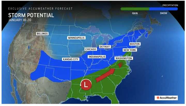
- A stormy pattern could bring snow on multiple occasions starting Saturday night, Jan. 18 into early next week.
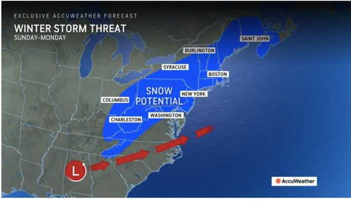
- One of the storm threats will come Sunday, Jan. 19, into Martin Luther King Jr. Day on Monday, Jan. 20.
"Multiple waves of Arctic air are gathering over northern Canada, targeting the central and eastern United States in the weeks ahead," said AccuWeather Lead Long-Range Meteorologist Paul Pastelok.
Click here for a new, updated story - Here's Projected Timing, Tracks For Back-To-Back Winter Storms
A frigid weather pattern will arrive Tuesday, accompanied by significantly colder temperatures. The first round of Arctic air sets the stage for several snow opportunities, with long-range models predicting a stormy weekend.
As forecasters monitor a winter storm potentially hitting Sunday into Monday, storm strength and track remain key. "How quickly the storm strengthens will help to determine its track," said AccuWeather Chief On-Air Meteorologist Bernie Rayno. "And consequently, where it tracks will determine where the band of accumulating snow versus rain sets up."
It's too early to predict possible snowfall amounts for the systems.
Check back to Daily Voice for updates.
Click here to follow Daily Voice Rumson-Fair Haven and receive free news updates.

