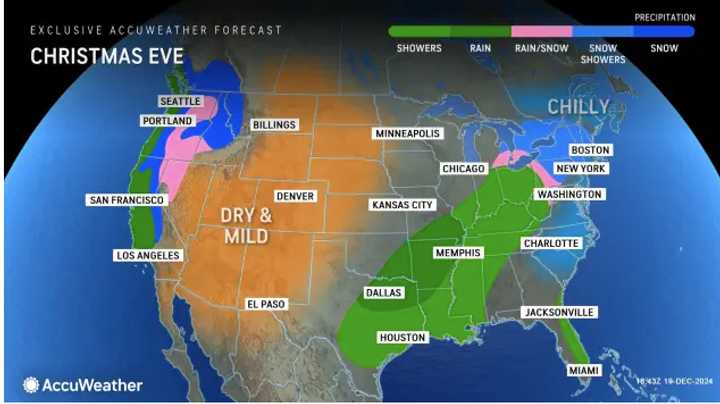
See the image above from AccuWeather for a look at areas where forecast models say snow and snow showers are possible along the East Coast on Tuesday, Dec. 24 (shown in the lighter shades of blue).
A weak storm is likely to move quickly eastward from the Great Lakes and Ohio Valley during the day on Dec. 24 and then through the central Appalachians, the mid-Atlantic and New England from the evening hours on Dec. 24 to early on Christmas Day, said AccuWeather Lead Long-Range Meteorologist Paul Pastelok.
"This storm will bring mostly rain but can bring some mixed frozen precipitation, especially over the northern tier and central Appalachians, where a wedge of cold air is most likely to linger," Pastelok added.
It's too early to predict possible snowfall amounts.
There's also a chance for more precipitation in areas farther south on Christmas Day on Wednesday, Dec. 25 triggered by moisture from the Gulf Coast.
"Depending on how quickly that Gulf storm expands northward, rain could extend from the lower Mississippi Valley to the Tennessee and Ohio valleys and into the interior Northeast late Christmas Day or on Thursday, Dec. 26," Pastelok said.
Check back to Daily Voice for updates.
Click here to follow Daily Voice Montville and receive free news updates.
