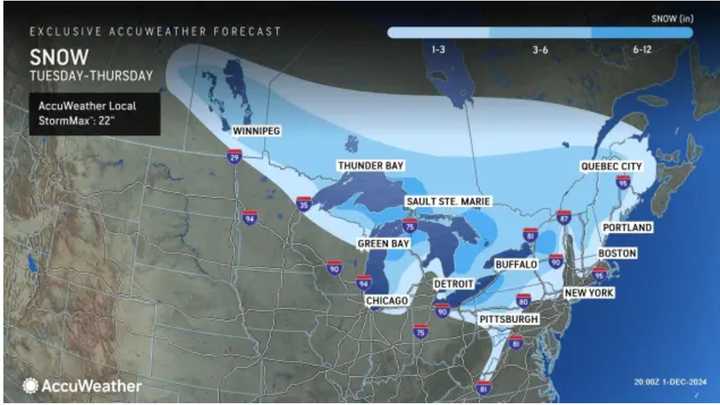
The time frame for the storm is Wednesday night, Dec. 4 into late Thursday morning, Dec. 5, according to the National Weather Service.
At the outset of the system, snow showers will occur throughout the region, and areas where the temperature stays at or below the freezing mark overnight could see up to half a foot of accumulation.
In areas where the temperature stays around the mid-30s, there will be a mix of rain, sleet, and snow.
Some locations farthest north and west could see 6 to 12 inches of snow. In those spots, snow will last into the Thursday morning commute, resulting in hazardous travel.
See the image above from AccuWeather for the latest snowfall projections.
The storm will also bring strong winds, with gusts up to around 25 miles per hour.
The system, which developed in Canada, will move eastward starting on Tuesday, Dec. 3.
Clouds will increase during the day on Wednesday ahead of the arrival of the system.
After the storm exits at around midday on Thursday, skies will gradually become partly to mostly sunny.
The outlook for Friday, Dec. 6 calls for sunny skies and brisk temperatures.
Check back to Daily Voice for updates.
Click here to follow Daily Voice Little Silver-Shrewsbury and receive free news updates.
