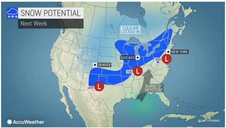
The potential for snow could cover a stretch of about 2,000 miles, according to AccuWeather forecasters.
In this region, the window for potential snow is overnight Tuesday, Nov. 15 into Wednesday morning, Nov. 16 in the areas shown in darker blue in the first image above.
"With cold air already in place, there is little question as to whether or not there will be snow that extends over a long distance next week," according to AccuWeather Long-Range Meteorologist Joe Bauer. (Click on the second image above.)
But first, with Nicole pushing off the coast, a quiet weekend is in store, according to National Weather Service.
As skies gradually clear on Saturday, Nov. 12, temperatures will once again climb into the upper 60s.
There is a chance for spotty showers overnight and on Sunday morning, Nov. 13, followed by partly sunny skies and cooler temperatures, with a high of only around 50 degrees. Skies will clear overnight and the temperature will fall to around the freezing mark, with wind-chill values in the mid 20s.
Monday, Nov. 14 will be sunny and brisk with a high temperature in the mid 40s.
Clouds will increase on Tuesday with precipitation arriving overnight. In areas where the low temperature is at or around the freezing mark, snowfall is possible.
Precipitation will taper off by around 1 p.m. Wednesday, with a changeover to rain in areas where there is snow as the high temperature climbs to a high temperature of around 45 degrees.
Click here to follow Daily Voice Edison and receive free news updates.

