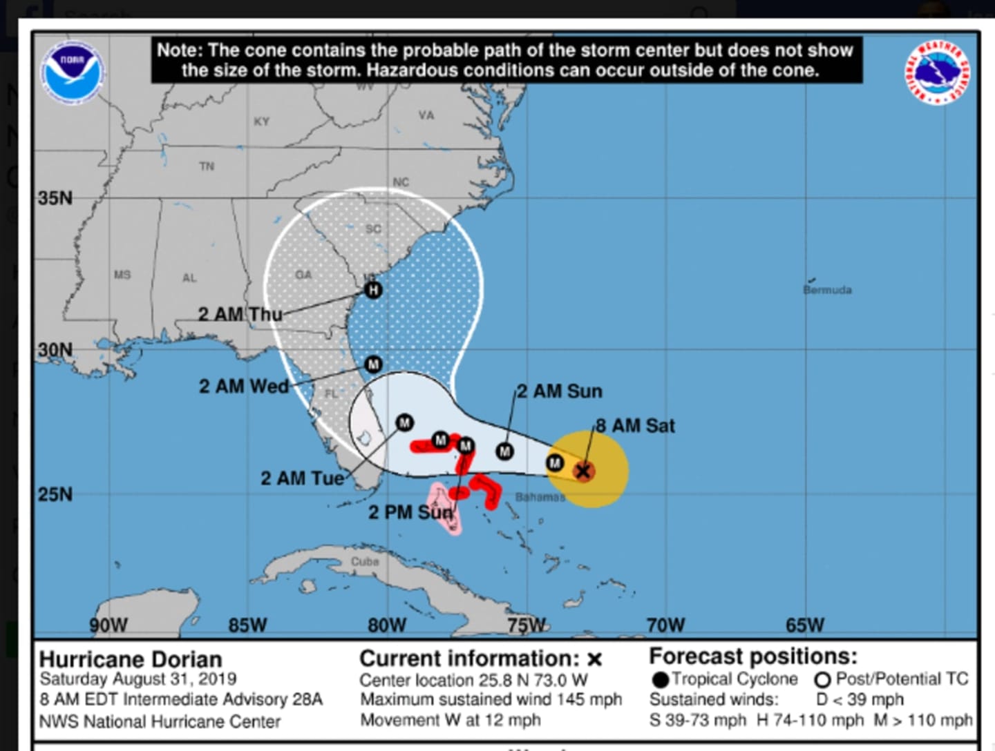


The latest projected path shows Florida may be spared a direct hit.
In a report released at 8 a.m. Saturday, Aug. 31, the National Hurricane Center said it now expects Dorian will take a sharp right turn around 2 a.m. Tuesday, Sept. 3, so the center of the storm doesn’t make Florida landfall.
The consensus path from several models also now has the storm headed for landfall near the South Carolina and Georgia border.
A gradual north/northeast trek is then expected with heavy and excessive rainfall along the way.
But it remains uncertain if the monster storm will have any impact on the New York metropolitan area.
If Dorian stays relatively close to the coast as it moves northeastward, then rough surf, coastal flooding and locally damaging wind may conceivably spread as northward as the southern New Jersey coast, according to AccuWeather.com.
With its slow-moving path, any impacts from Dorian in this area would not be felt until the end of next week. There's currently a chance for rain and storms on Saturday, Sept. 7.
As for this Saturday, Aug. 31, morning clouds will give way to mostly sunny skies. The high temperature will be near 80 degrees.
Sunday, Sept. 1 will be partly sunny with a high temperature in the mid 70s. Clouds will increase during the late afternoon and evening.
Look for a mostly cloudy day Labor Day on Monday, Sept. 2, with a high temperature in the upper 70s. There will be a chance of showers, with thunderstorms also possible, starting at around noontime and continuing through the evening.
Check back to Daily Voice for updates.
Click here to follow Daily Voice Yorktown and receive free news updates.