

Catastrophic Hurricane Dorian turned deadly as it barreled over the Bahamas on Sunday, Sept. 1.
The storm, the strongest ever in the Bahamas, made landfall on three different islands with sustained winds of 185 miles per hour and gusts up to 225 mph.
Late Sunday night, a 7-year-old drowned in Abaco in the northern Bahamas and his sister remains missing as the historic storm is causing flooding, missing rooftops, snapped trees and overturned vehicles.
At 8 a.m. Monday, Sept. 2, Hurricane Dorian was centered 35 miles east of Freeport, Grand Bahama Island, and about 120 miles east of West Palm Beach, Florida. It has essentially stalled out, moving at just 1 mph.
While Dorian is still expected to spare the United States a direct hit, it will move "dangerously close" to Florida's east coast as a Category 4 storm late Monday where it will remain through Wednesday evening, Sept. 4, the National Hurricane Center said in a new advisory issued Monday morning. It now has maximum sustained winds are near 165 mph with higher gusts.
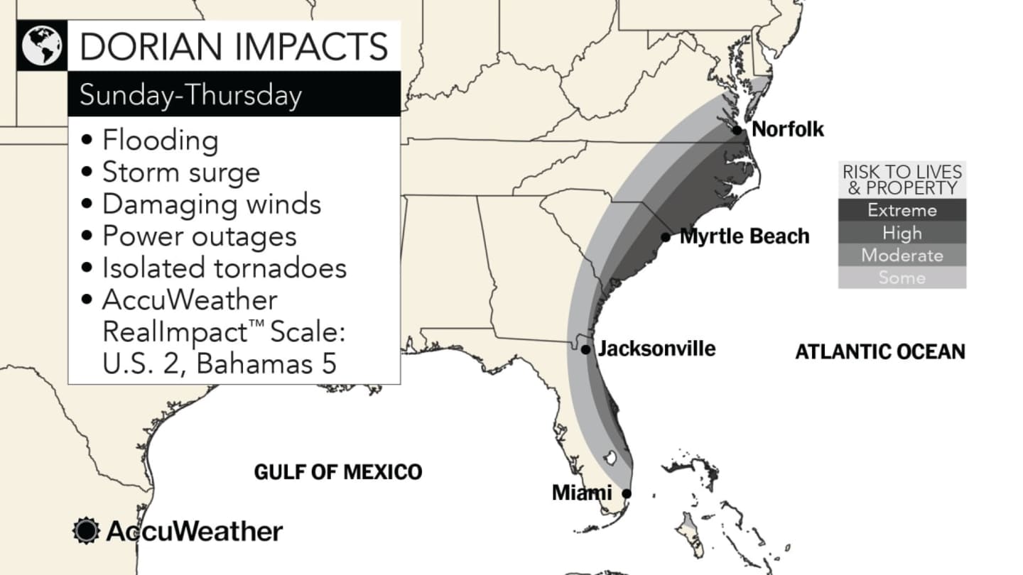
Dorian will then continue a northern trek in which coastal areas in the states shown in the first image above will be at risk for flooding, storm surge, damaging winds and power outages.
Mandatory evacuations were underway in some parts of Florida and ordered for later Monday for the coastlines of South Carolina and Georgia.
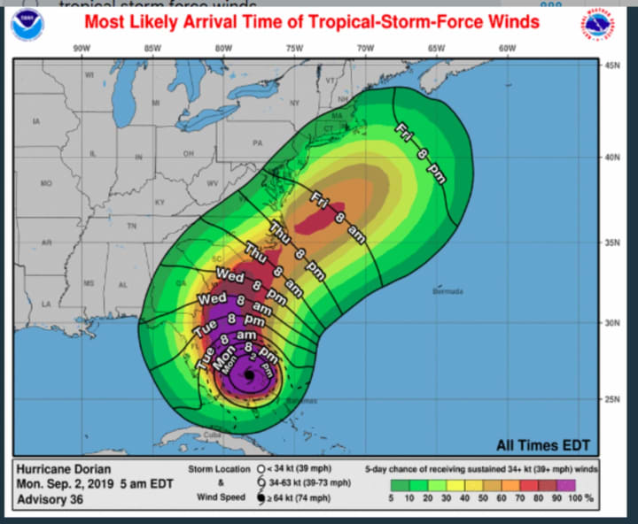
The New York metropolitan area could see Tropical Storm-force winds from Dorian on Friday, Sept. 6. (See second image above.)
The storm is expected to finally push off the east coast early Saturday, Sept. 7. (See third image above.)
In the New York metro area, there's currently a chance for rain and storms on Wednesday, Sept. 4, Thursday, Sept. 5 and Friday, Sept. 6.
Look for a mostly cloudy day Labor Day on Monday, Sept. 2, with a high temperature in the upper 70s. There will be a chance of showers, with thunderstorms also possible, starting at around 2 p.m. and continuing through the evening. About three-quarters of an inch of rainfall is possible.
Tuesday, Sept. 3 will be mostly sunny with a high temperature in the low 80s.
Check back to Daily Voice for updates.
Click here to follow Daily Voice Yorktown and receive free news updates.