
is expected to intensify and grow in size as it nears Florida's coast, where it is expected to make landfall as a Category 3 hurricane. toward the end of Labor Day Weekend.
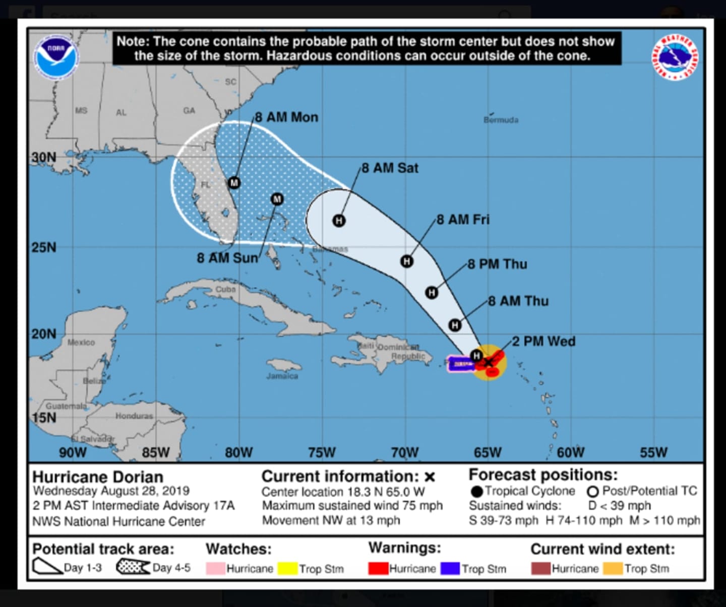
Dorian is projected to become a major hurricane on Saturday morning, Aug. 31 when it is still over open water in the Atlantic. It is then expected to cross the Bahamas on Sunday, Sept. 1 before making landfall in central Florida, likely in the area of West Palm Beach, early Monday morning, Sept. 2. (See first image above.)
Upwards of 12 inches of rain are possible.
A State of Emergency has been declared in Florida.
The storm is expected to weaken to a Category 1 storm after landfall, but if it continues on a westward path over Florida, it could strengthen again over the open water off the west coast of the state, and possibly make a second landfall if it moves north, possibly over the Florida Panhandle.
Meanwhile, this region will see picture-perfect weather throughout the lend of the weekend before seeing a change in that pleasant pattern on Labor Day.
Thursday, Aug. 29 will be mostly sunny, with a high temperature around 8- degrees.
Friday, Aug. 30 will be sunny, with a high temperature again in the low to mid 80s.
Saturday will be sunny, with a high near 80 degrees.
Sunday will be partly sunny with a high in the upper 70s. Clouds will increase during the day and there will be a slight chance of storms in the evening.
Look for a mostly cloudy day Labor Day on Monday, with a high temperature in the upper 70s. There will be a chance of showers, with thunderstorms also possible, between 1 p.m. and 7 p.m.
Check back to Daily Voice for updates.
Click here to follow Daily Voice Yorktown and receive free news updates.