"Multiple waves of Arctic air are gathering over northern Canada, targeting the central and eastern United States in the weeks ahead," according to AccuWeather Lead Long-Range Meteorologist Paul Pastelok.
The bitter cold will begin on Tuesday, Jan. 14, with temperatures about 10 to 20 degrees below historical averages.
A stormy weather pattern is anticipated early next week, with snow possible on several occasions, according to long-range forecast models.
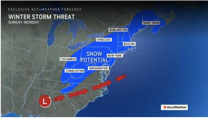
A look at areas where a winter storm threat is possible Sunday, Jan. 19 into Monday, Jan. 20 is shown in the first image above from AccuWeather.com.
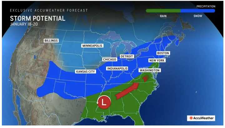
"There will be a brief pause in the Arctic outbreaks during that time, allowing for the potential development of significant storms originating from the South Central states or the Gulf," Pastelok said. "These storms may either track toward the Great Lakes or the coastal Northeast. The trajectory of the storms will determine the distribution of rain versus snow, as well as the direction of subsequent cold blasts."
For look at areas where a winter storm threat is possible Sunday, Jan. 19 into Monday, Jan. 20, see the first image above.
Check back to Daily Voice for updates.
Click here to follow Daily Voice Yorktown and receive free news updates.

