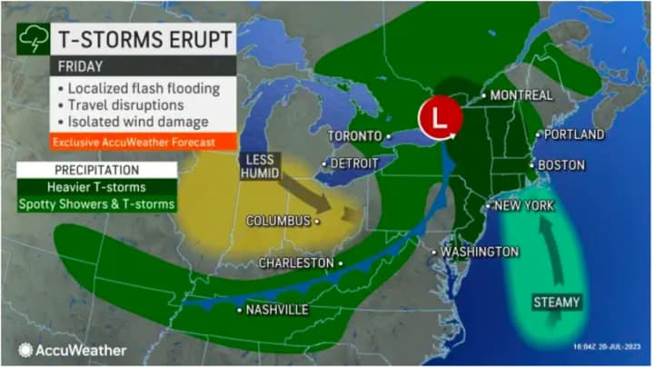
"Uncertainty continues to be the coverage of storms and severity. For the most part, it appears that these storms will weaken as it approaches our area," the National Weather Service said in a statement issued late Thursday afternoon, July 20.
The first round of showers and storms in the morning will be followed by another round Friday afternoon and evening, the weather service said.
About an inch to an inch-and-a-half of rainfall is expected on Friday, with locally higher amounts possible.
"Locally heavy downpours may produce isolated to scattered areas of flash flooding," the National Weather Service said.
Precipitation will gradually wind down overnight Friday into Saturday morning, July 22, leading to a dry weekend with high temperatures in the mid-80s both Saturday and Sunday, July 23.
Check back to Daily Voice for updates.
Click here to follow Daily Voice Yorktown and receive free news updates.


