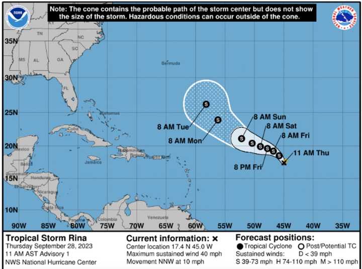
As of Thursday afternoon, Sept. 28, the center of newly named Tropical Storm Rina is in the eastern Atlantic, moving toward the north-northwest at around 10 miles per hour, according to the National Hurricane Center.
Maximum sustained winds are around 40 miles per hour with higher gusts.
On the forecast track, Rina is expected to move north-northwest west over open water.
For the storm's projected path through Tuesday, Oct. 3, see the first image above.
Rina is the 17th named storm of the 2023 season.
In early August, the National Oceanic and Atmospheric Administration increased its prediction for named storms this year from 12 to 17 to 14 to 21.
Sean is next up on the 2023 list of Atlantic storm names.
For more on Rina from the National Hurricane Center, click here.
The hurricane season began Thursday, June 1 and ends on Thursday, Nov 30.
Check back to Daily Voice for updates.
Click here to follow Daily Voice Yonkers and receive free news updates.

