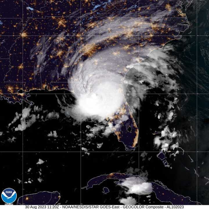
The massive storm's center came ashore at Keaton Beach in Florida’s Big Bend region (where the panhandle transitions to the peninsula) at about 7:45 a.m. Wednesday, Aug. 30 with wind gusts of around 120 miles per hour.
Idalia formed late Saturday afternoon, Aug. 26 as a tropical depression before being upgraded on Sunday, Aug. 27 to a tropical storm and to a Category 1 hurricane in the early hours of Tuesday morning, Aug. 29.
"Catastrophic storm surge and damaging winds are ongoing," the National Hurricane Center said in a statement just before 8 a.m. Wednesday.
Widespread power outages that could last for weeks are being reported in the heavily wooded Big Bend area.
More than a dozen tornado warnings have also been reported in northern Florida as of early Wednesday morning.
After barreling through Florida, Idalia is predicted to remain a hurricane as it moves into Georgia later Wednesday before moving close to the Carolina coastline on Thursday, Aug. 31 when it is finally expected to be downgraded to tropical-storm status.
For Idalia's current projected path and timing, see the second image above or click here for the National Hurricane Center's latest update on Idalia.
Idalia is the ninth named storm of the Atlantic hurricane season. View the 2023 list of Atlantic storm names here.
This continues to be a developing story. Check back to Daily Voice for updates.
Click here to follow Daily Voice Yonkers and receive free news updates.

