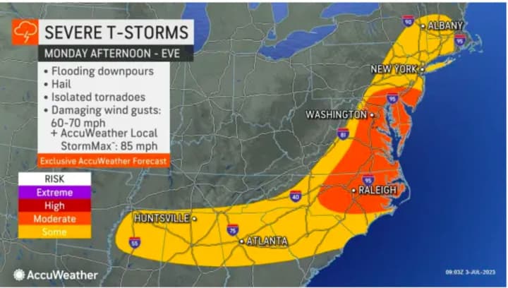
A system moving up the East Coast is most likely to affect this region late Monday afternoon, July 3 into the evening.
"Scattered showers and thunderstorms are expected to develop this afternoon and evening," the National Weather Service said in a Hazardous Weather Outlook statement issued early Monday morning. "There is the potential for a few of the storms to become strong to severe, with strong winds the main threat."
In addition, "heavy rainfall could produce areas of mainly minor flooding," the statement said.
It will be partly sunny for much of the first part of the day on Monday with high temperatures ranging from the low to mid-80s.
The outlook for Tuesday, July 4 calls for clouds with some breaks of sunshine in the morning followed by scattered showers and thunderstorms in the afternoon and evening throughout the region.
In eastern New England, some of the storms could produce gusty winds, heavy rain, and frequent lightning.
Tuesday's high temperature will generally be in the low-80s.
It will be warm both Wednesday, July 5, and Thursday, July 6 with mostly sunny skies both days and a high temperature in the upper 80s.
Friday, July 7 will be mostly sunny with a high temperature in the mid-80s. There's a slight chance of scattered showers in the afternoon and evening.
Check back to Daily Voice for updates.
Click here to follow Daily Voice Yonkers and receive free news updates.


