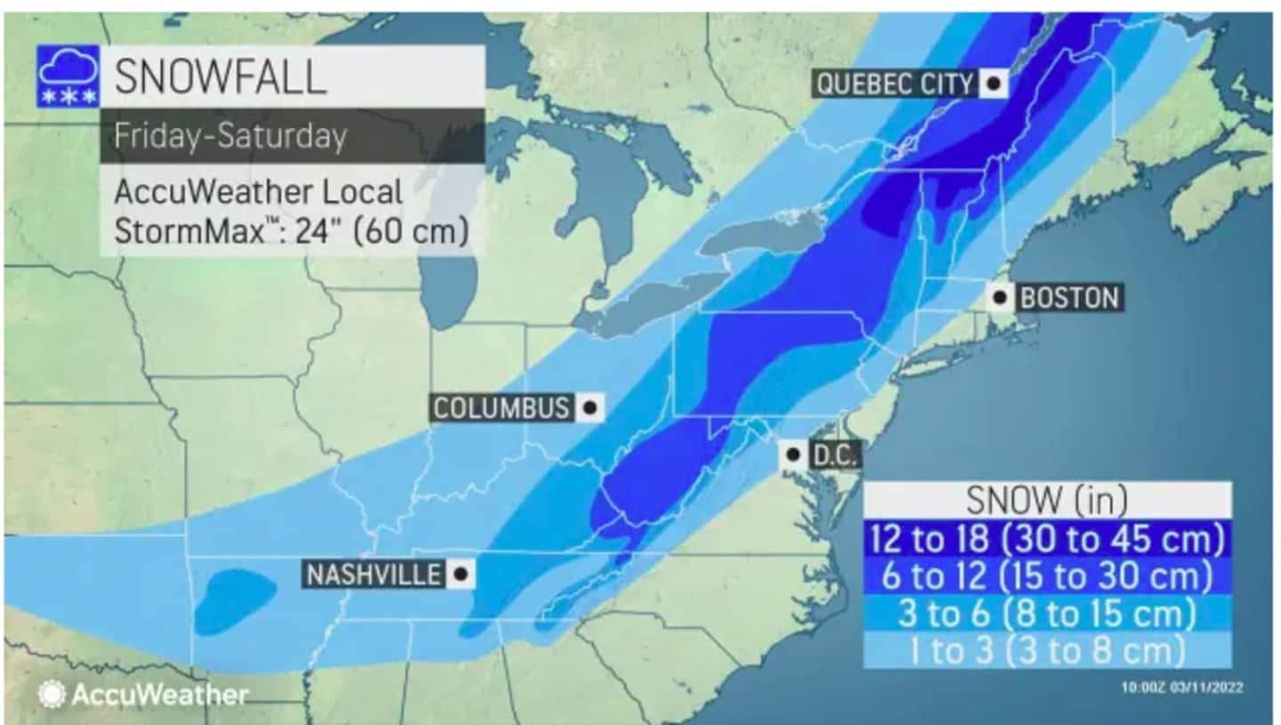


Areas in light blue in the first image above should see between 1 and 3 inches of snowfall, according to AccuWeather.com. Farther inland, in Columbia blue, 3 to 6 inches is forecast.
Areas in blue should see 6 to 12 inches with some spots in upstate New York and northern New England (shown in dark blue) expected to get 12 to 18 inches of accumulation, with snowfall rates up to an inch an hour possible from midday to late in the afternoon Saturday.
For a closer look at areas expected to see heavy snowfall and the highest accumulation amounts from the National Weather Service, click on the second image above.
Click on the third image above to see projected arrival times for snowfall from west to east.
For many in the region, though, damaging winds will be the storm's main threat. A Wind Advisory is in effect starting late Saturday morning lasting until the overnight hours.
Wind gusts between 40 and 70 miles per hour are expected during the height of the storm during the afternoon and evening Saturday. (Click on the fourth image above.)
The powerful system will wind down just as it's time to "Spring Forward" with the start of Daylight Saving Time at 2 a.m. Sunday when clocks are changed ahead one hour.
Sunday morning will start with a mix of clouds and sunny on a brisk and blustery day with the high temperature in the low 30s and wind gusts up to 30 miles per hour or more. Clouds will increase in the afternoon.
Monday, March 14 will be mostly sunny and more seasonable with a high temperature around 50.
Check back to Daily Voice for updates,
Click here to follow Daily Voice White Plains and receive free news updates.