The system is on track for Tuesday night, Aug. 30.
"This potent cold front is set to swing through the Northeast on Tuesday and bring the opportunity for some potentially powerful storms," AccuWeather Meteorologist Mary Gilbert said.
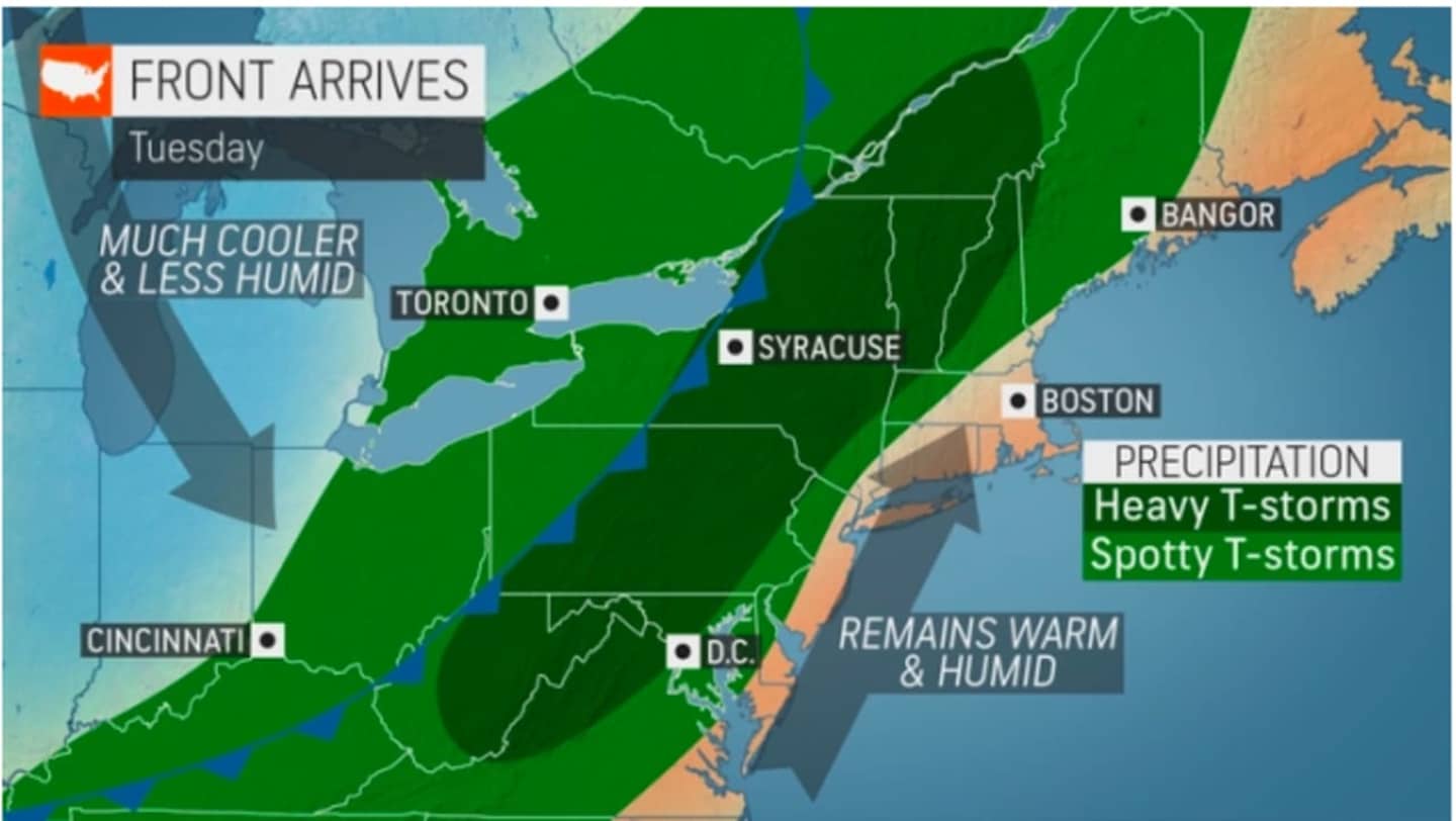
Conditions will be warm and humid prior to the arrival of the cold front, according to the National Weather Service.
The high temperature Monday, Aug. 29 will be in the upper 80s with skies gradually becoming sunny after a mostly cloudy start.
Tuesday will be mostly sunny and hot most of the day, with a high temperature again in the upper 80s.
"The unseasonably warm, humid air in place early this week can set the stage for a dramatic clash of air masses," said Gilbert.
Clouds will increase Tuesday afternoon prior to the storm's arrival in the evening.
Areas expected to see the most severe storms are shown in green in the image above.
The storm should move out quickly, with clearing overnight leading into the final day of the month on Wednesday, Aug. 31, which will be sunny, and much more comfortable, with a high temperature in the low to mid 80s.
Thursday, Sept. 1 will be sunny and pleasant with a high temperature in the low 80s.
Look for more of the same on Friday, Sept. 2, with sunny skies and a high temperature of around 80 degrees.
Check back to Daily Voice for updates.
Click here to follow Daily Voice White Plains and receive free news updates.