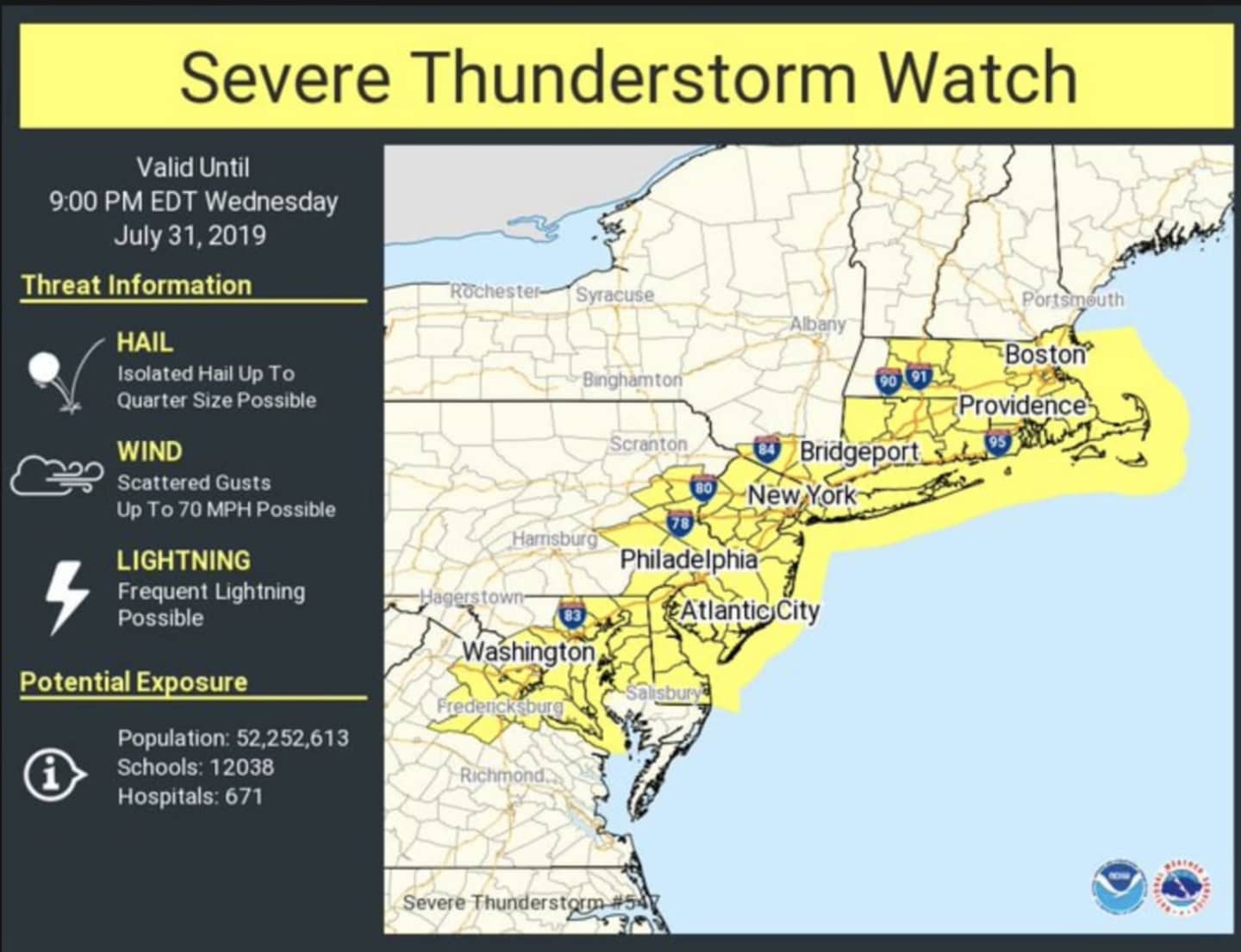
The watch, issued just before 1:30 p.m. on Wednesday, July 31, is in effect until 9 p.m. The watch covers New York City, Long Island, Westchester, Putnam, Rockland, Orange and Fairfield counties.
Showers and thunderstorms that will bring drenching downpours, thunder, frequent lightning and damaging wind gusts to the region are likely Wednesday afternoon and evening.
Localized flash flooding and hail are also possible, the National Weather Service said in a Hazardous Weather Statement.
Strong wind gusts of up to 70 miles per hour could bring down trees and tree limbs, leading to power outages.
A half-inch of rainfall is possible during the day with another half-inch at night.
Look for storm activity to wrap up by 3 a.m. Thursday, Aug. 1.
The passage of the storms will lead to more comfortable temperatures to end the workweek.
Thursday will be mostly sunny and pleasant with a high temperature around 85 degrees.
Friday, Aug. 2 will also be mostly sunny with the high temperature in the low 80s.
Check back to Daily Voice for updates.
Click here to follow Daily Voice White Plains and receive free news updates.