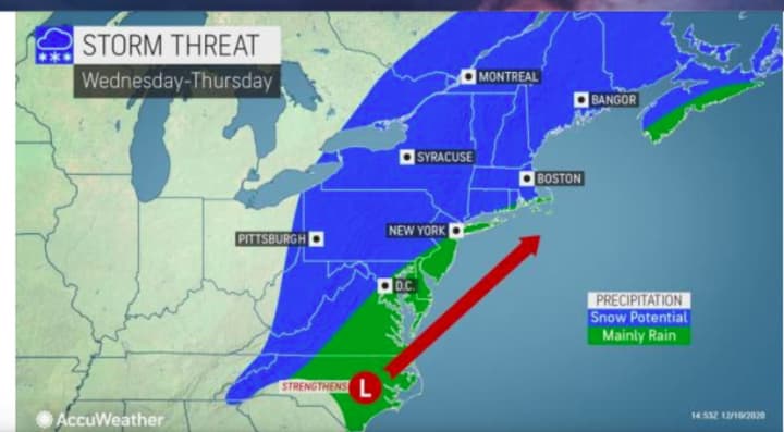
A potential blockbuster storm system on track to sweep through the Northeast next week could lead to just that.
It's far from a sure thing right now, but forecasters are recognizing some early signals that a storm could come together and tap enough cold air to produce snow during the middle of next week, AccuWeather said.
The current models have the time frame for the storm being Wednesday, Dec. 16 into Thursday, Dec. 17. (See image above.)
"At this early stage, we are just providing a heads-up on a potential storm that could have a major negative impact on travel from rain or snow along the coast and snow across the interior Northeast with the target days being Wednesday and Thursday," AccuWeather Senior Meteorologist Brett Anderson said.
Near-normal to slightly below-normal temperatures are expected across the Northeast early next week, following weekend rain showers.
If the storm develops to its potential, up to a foot of snowfall accumulation is possible in the interior Northeast, said Accuweather.
There is still much uncertainty surrounding the storm's potential strength and track.
Check back to Daily Voice for updates.
Click here to follow Daily Voice White Plains and receive free news updates.


