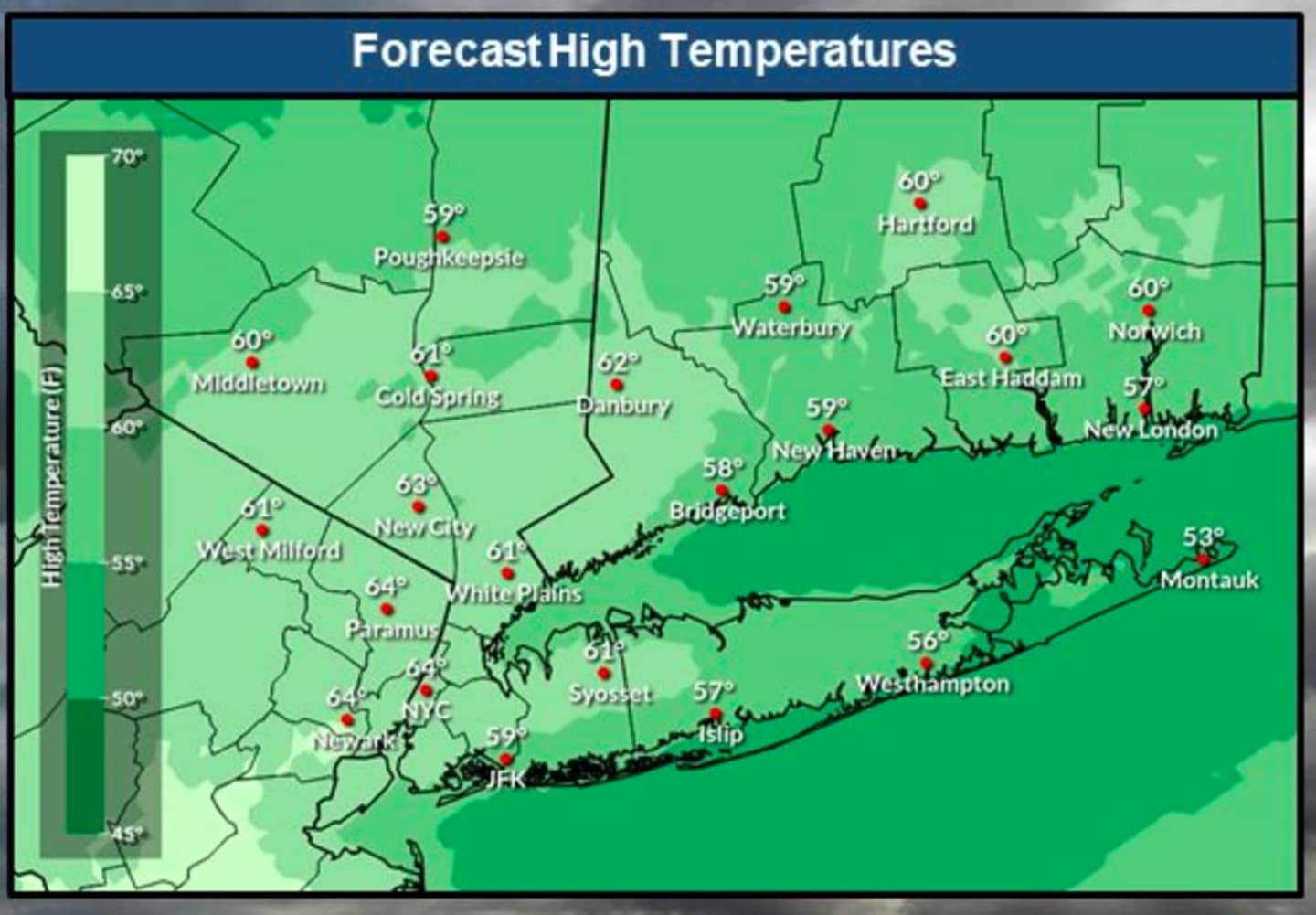
Temperatures will top off at around the 60-degree mark on Wednesday, Jan. 4, according to the National Weather Service. (See the image above.) It will be another mostly cloudy day with some peaks of sunshine.
As a cold front approaches late in the day, there will be rainfall in the afternoon and evening.
Temperatures will fall on Thursday, Jan. 5 with the high temperature between 10 to 15 degrees below Wednesday's high. It will remain cloudy with scattered showers.
It will become noticeably colder still overnight Thursday into Friday, Jan. 6, leading to a chance for a wintry mix and light snow in areas where the low temperature falls at or below the freezing mark, especially areas farthest north and inland.
Friday's high temperature will be in the mid 40s with cloudy skies and a chance for more rain.
It will remain cold on Saturday. Jan. 7, but there will be gradual clearing, leading to a mainly sunny day with a high temperature of around 40 degrees.
Clouds will increase overnight, and in areas where the temperature drops at or below the freezing marks, snow showers will be possible into Sunday morning, Jan. 8.
Check back to Daily Voice for updates.
Click here to follow Daily Voice Tarrytown-SleepyHollow and receive free news updates.