

The time frame for Isaias' strongest impact in this area during the afternoon and into the evening on Tuesday, Aug. 4.
A Tropical Storm Warning and Flash Flood Watch cover the entire region from 6 a.m. Tuesday to 6 a.m. Wednesday, Aug. 5. A Coastal Flood Advisory is in effect for areas along the coast.
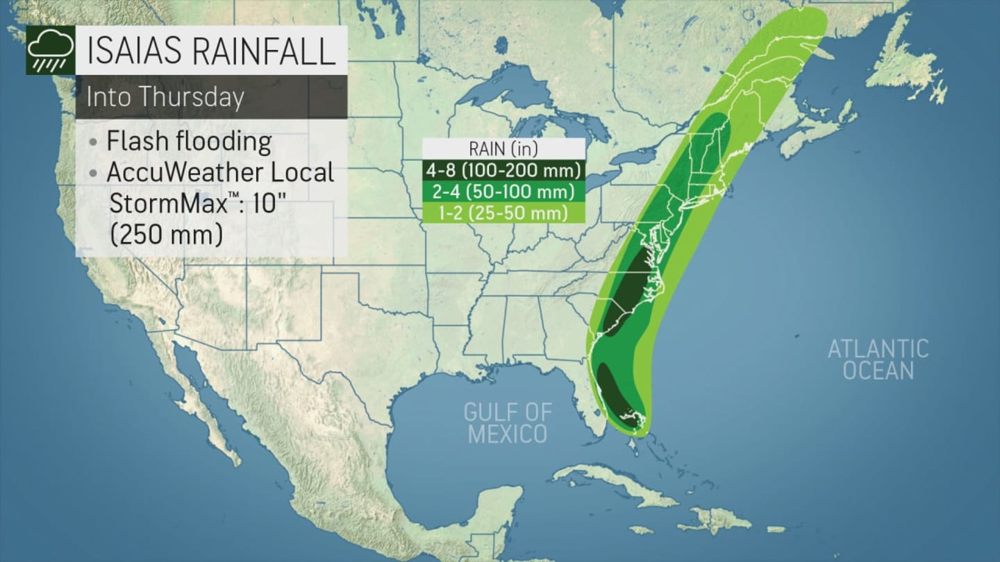
Locally heavy rain is expected with a widespread 2 to 4 inches, with localized amounts up to 6 inches possible. For projected rainfall amounts, see the first image above.
For projected wind-gust maximums, see the second image above.
The latest forecast track for Isaias was released Monday morning, Aug. 3 by the National Hurricane Center. (See the third image above.)
The effects from Tropical Storm Isaias are expected to diminish quickly from southwest to northeast across the area Tuesday night into Wednesday morning, the National Weather Service said.
This continues to be a developing story. Check back to Daily Voice for updates.
Click here to follow Daily Voice Tarrytown-SleepyHollow and receive free news updates.