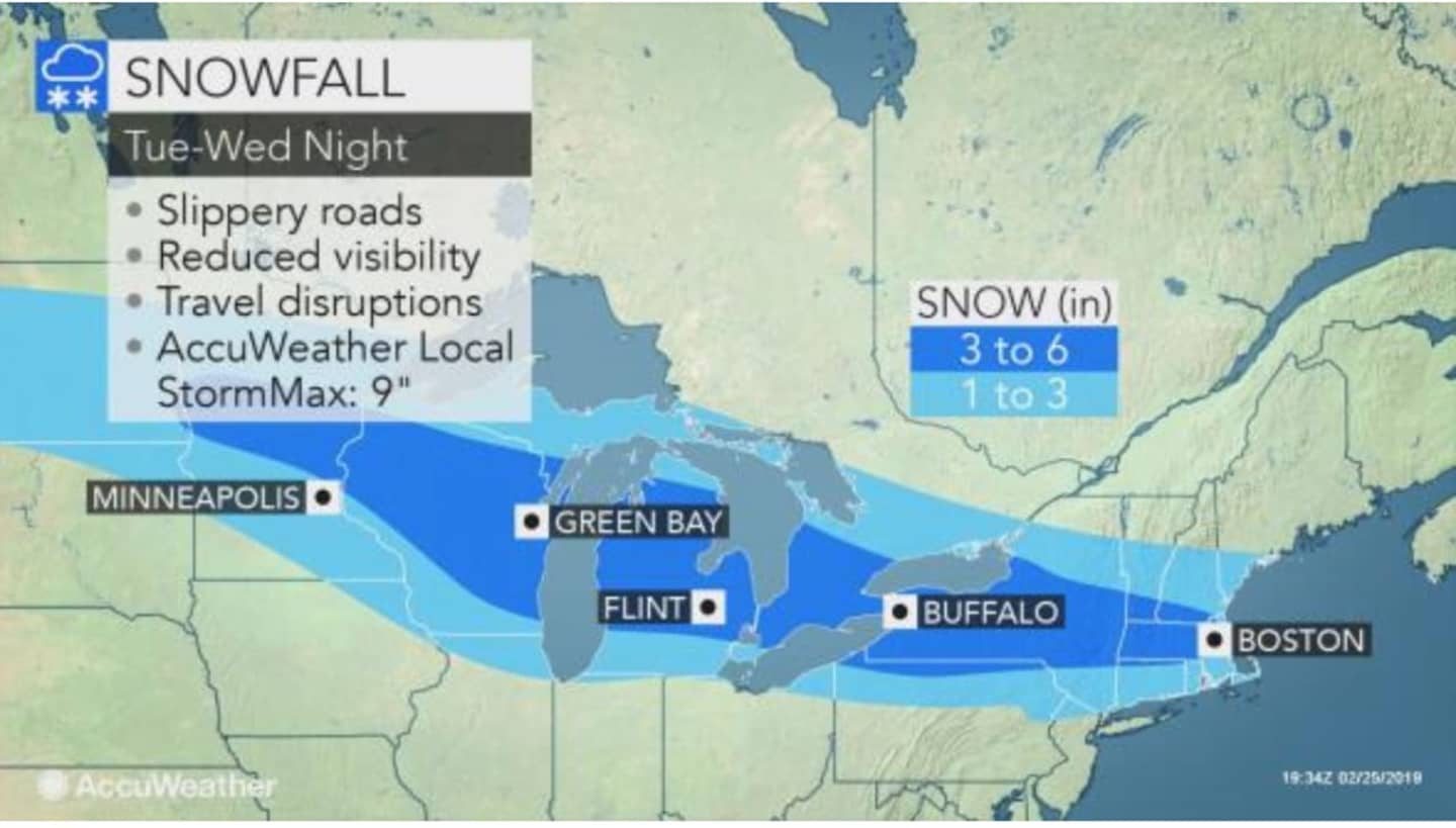

A total of 1 to 3 inches of accumulation is expected for most of the region. (See first image above.) Well north of I-84, including Northern Dutchess, 4 to 6 inches is possible.
Tuesday will be sunny with a high around 35 degrees and once again windy at 16 to 21 mph and gusts as high as 30 mph, making for a wind-chill factor temperature between 5 and 15 degrees.
Wednesday will be mostly cloudy with a high in the upper 20s and wind-chill value of between 10 and 20 degrees. The chance for snow starts after 1 p.m.
Light snow then becomes likely late in the afternoon with snow likely after 8 p.m. and through midnight.
Thursday, Feb. 28 will be partly sunny with a high in the mid 30s.
Friday, March 1 will be mostly cloudy with a high in the upper 30s. There's a chance of snow overnight Friday into Saturday, March 2. It's too early to project possible snowfall amounts.
Check back to Daily Voice for updates.
Click here to follow Daily Voice Tarrytown-SleepyHollow and receive free news updates.