
After a one-day reprieve from the barrage of wintry weather on Wednesday, Feb. 17, a new storm taking aim on the region has the potential to dump a significant amount of snowfall.
The time frame for the new storm is Thursday, Feb. 18 into Friday, Feb. 19, with the potential for moderate to heavy snowfall and a brief wintry mix, the National Weather Service said in a statement issued Tuesday.
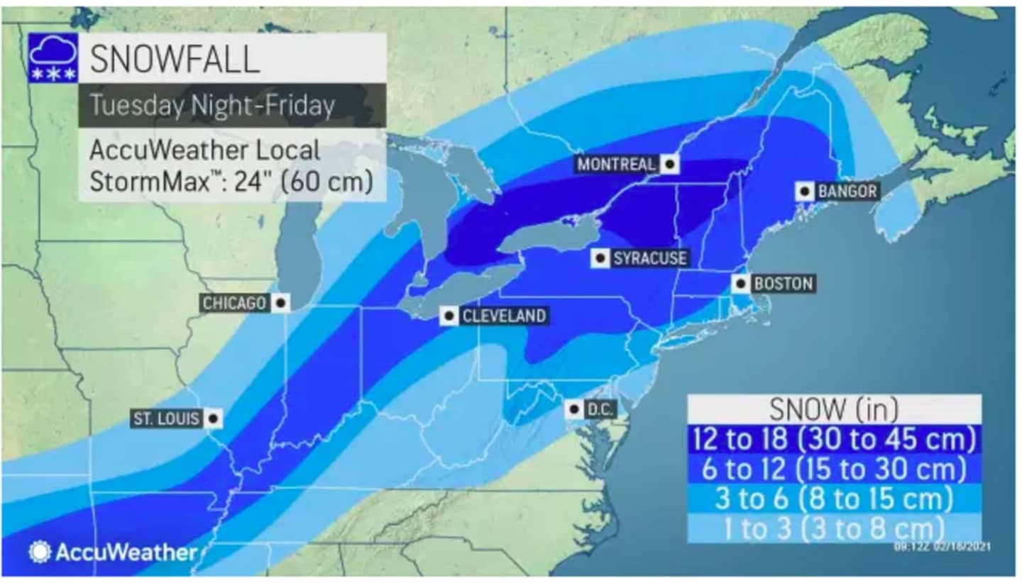
The heaviest snow in the Northeast is expected from northern and central Pennsylvania through upstate New York and central and northern New England, according to AccuWeather.
The first snowfall projections released by AccuWeather show the potential for 6 to 12 inches of snowfall for areas north of I-287 in New York and the Merritt Parkway in Connecticut, and Massachusetts.
New York City, Long Island, southern Westchester, and coastal Connecticut could see 3 or more inches of snowfall.
For the snowfall projection map of the entire region, see the first image above.
On Tuesday, the chance for rain and showers will last until early in the afternoon. The high temperature will climb to the mid to upper 40s.
Wednesday will be sunny and cold Wednesday with a high temperature in the low to mid 30s, and wind-chill values between 10 and 20 degrees.
Clouds will thicken overnight Wednesday ahead of the storm system, which is now on track to arrive shortly before nightfall on Thursday and continue through the evening before the snow is expected to mix with sleet and freezing rain overnight into early Friday morning, Feb. 19.
Snowfall projections could increase or decrease as there remains uncertainty surrounding the track, duration, and strength of the system.
Check back to Daily Voice for updates.
Click here to follow Daily Voice Tarrytown-SleepyHollow and receive free news updates.