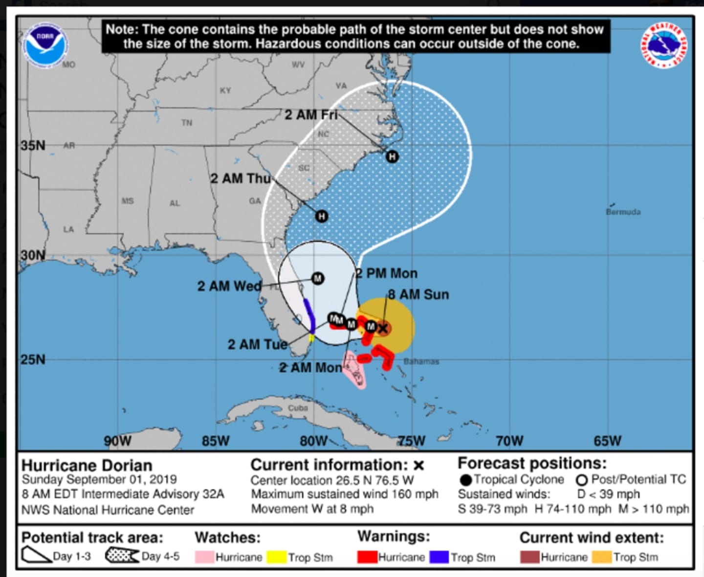

The slow-moving monster storm is about 200 miles east of West Palm Beach, Florida, meandering at about 8 mph.
In its latest advisory, issued at 8 a.m. Sunday, the National Hurricane Center still predicted Florida would avoid a direct hit, with the eye of the storm remaining about 70 miles offshore.
“Since Dorian is forecast to slow down and turn northward as it approaches the coast, life-threatening storm surge and dangerous hurricane-force winds are still possible along portions of the Florida east coast by the middle part of this week,” the advisory said. t officials.”
For the latest projected path and timing, see the first image above.
A gradual north/northeast trek is expected with heavy and excessive rainfall along the way in Georgia and the Carolinas.
But it remains uncertain if the monster storm will have any impact on the New York metropolitan area.
If Dorian stays relatively close to the coast as it moves northeastward, then rough surf, coastal flooding and locally damaging wind may conceivably spread as northward as the southern New Jersey coast, according to AccuWeather.com.
In the New York metro area, there's currently a chance for rain and storms on Wednesday, Sept. 4 and Saturday, Sept. 7.
Sunday, Sept. 1 will be partly sunny with a high temperature in the mid 70s. Clouds will increase during the afternoon and evening.
Look for a mostly cloudy day Labor Day on Monday, Sept. 2, with a high temperature in the upper 70s. There will be a chance of showers, with thunderstorms also possible, starting at around 2 p.m. and continuing through the evening. About three-quarters of an inch of rainfall is possible.
Tuesday, Sept. 3 will be mostly sunny with a high temperature in the low 80s.
Check back to Daily Voice for updates.
Click here to follow Daily Voice Suffolk and receive free news updates.