

Farther south, including New York City, Long Island, as well as Westchester, Putnam, Rockland, Orange and Fairfield counties, precipitation will be all rain as the low temperature will stay above freezing.
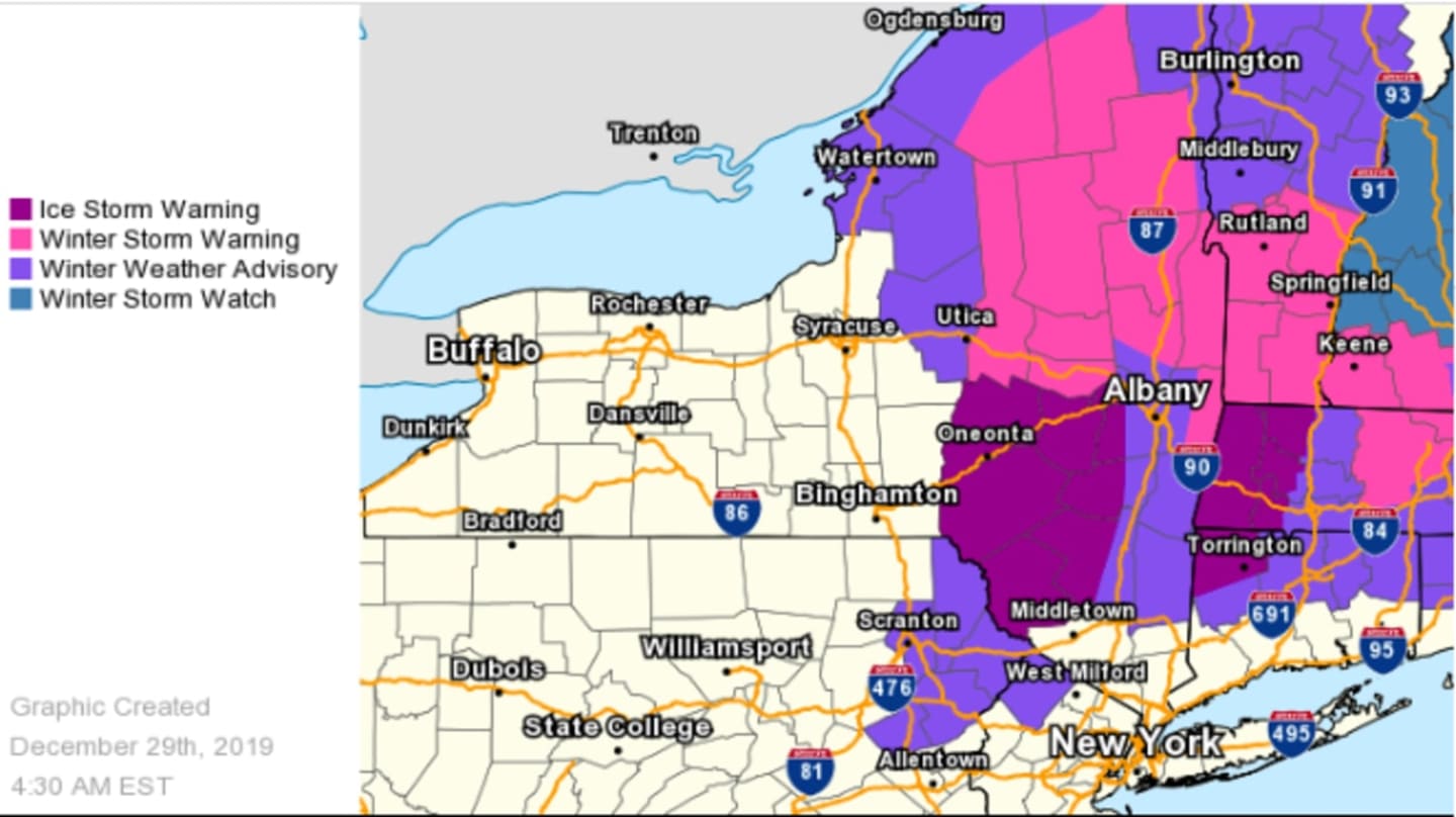
Winter Weather Advisories are in effect from 5 p.m. Sunday, Dec. 29 through 7 a.m. Tuesday, Dec. 31 for the counties shown in purple in the first image above, including Dutchess and Ulster counties in the Hudson Valley and Litchfield County in Connecticut. An Ice Storm Warning is in effect from 4 p.m. Sunday to 1 a.m. Tuesday for the areas in New York, Connecticut and Massachusetts shown in pink in the first image above, including Sullivan County in the Hudson Valley.
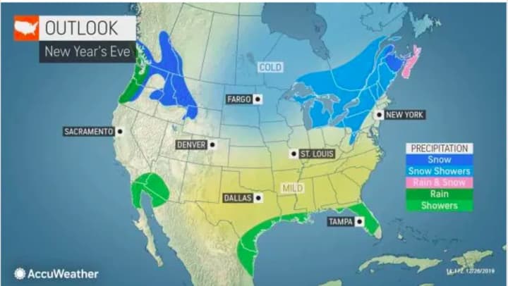
The good news is that the system will push off the coast before New Year's Eve Day, leading to a big change to start the new decade, with dry weather into New Year's Day.
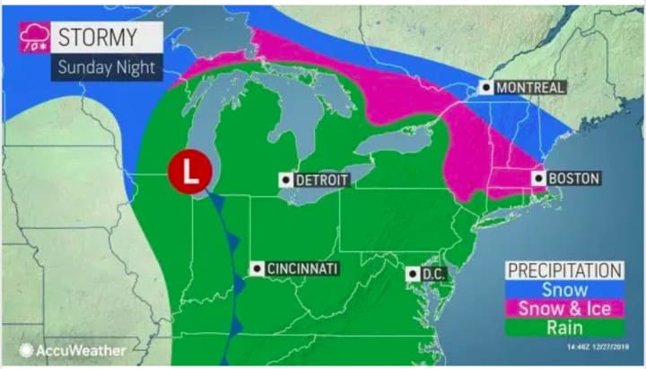
The storm will bring mainly rain, heavy at times, and gusty winds to most of the region, but the areas 100 miles or more north of New York City seeing the wintry precipitation.
Here's the five-day outlook:
Sunday, Dec. 29: Clouds will increase prior to the arrival of the storm in the afternoon, sometime after 3 p.m. Since the high temperature will in the low 40s, precipitation will be all rain for most of the region. Rain will become steady after 7 p.m. and be heavy at times in the evening with gusty winds and slippery travel possible. The low temperature will be around 40 degrees. Up to three-quarters of an inch is possible before daybreak.
Monday, Dec. 30: The storm will kick into high gear with rain at times throughout the day. The high temperature will be in the low 40s. The storm will finally wind down Monday night after another inch of rainfall, with the wintry mix well north and inland.
Tuesday, Dec. 31: New Year's Eve Day will start with light rain likely before noon with a wintry mix far north and inland. It will be a cloudy day with a high temperature in the mid 40s. As for the evening, look for mostly cloudy skies and a temperature in the low 30s when the ball drops in Times Square. There could be snow showers at night in upstate New York and upstate Connecticut.
Wednesday, Jan. 1: New Year's Day and the start of 2020 will be mostly sunny with a high temperature around 40 degrees.
Thursday, Jan. 2: Sunny with a high temperature in the low 40s.
Check back to Daily Voice for updates.
Click here to follow Daily Voice Southwest Dutchess and receive free news updates.