
Clouds are on the increase in the morning Sunday, March 31 ahead of the cold front's arrival. Showers will make their way through from the west 11 a..m. to 2 p.m. and then 2 p.m. to 5 p.m. to the east. Between a quarter to a half-inch of precipitation is expected.
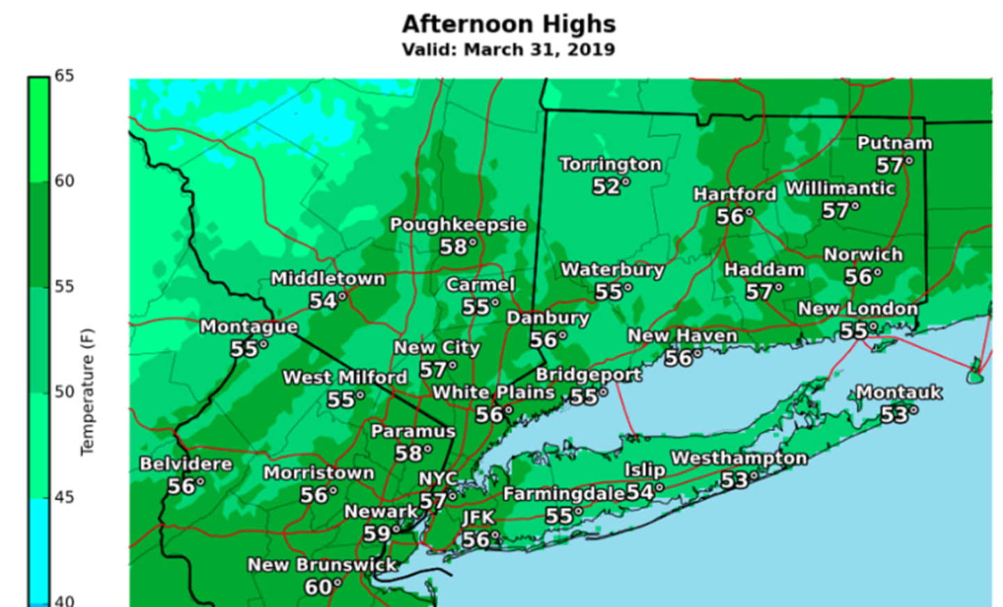
High temperatures will be in the mid 50s. (See first image above.)
Then comes the sharp drop in temperatures as the cold front arrives with the mercury falling into the upper 40s late in the afternoon as March goes out like a lion -- and not a lamb.
The low temperature will plummet to around 30 degrees with a wind-chill factor between 20 and 25.
Monday, April 1 will be sunny and breezy, with a high temperature only in the mid 40s. (See second image above.) The wind-chill factor will make it feel like it's between 20 n 0 degrees with northwest winds up to 20 miles per hour with 30 mph gusts.
Tuesday, April 2 will be less cold with calm winds and a high temperature in the low 30s.
Check back to Daily Voice for updates.
Click here to follow Daily Voice Southwest Dutchess and receive free news updates.