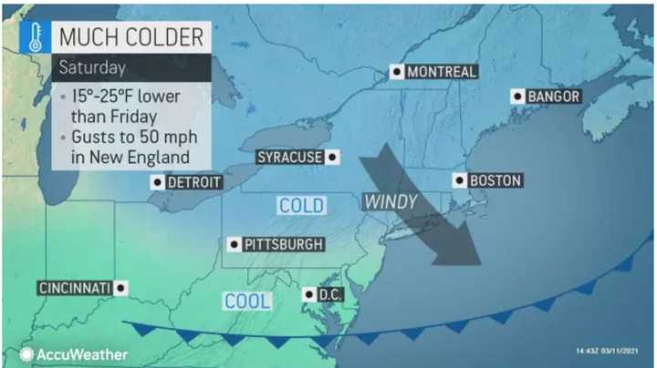
A nearly two-week-long stretch featuring plenty of sunshine, with unseasonably warm temperatures the last few days, will be followed by a return of cold air, as well as a mix of precipitation, including the chance for some snow.
"Those who were enjoying the warmth this week in the Northeast will be in for a drastic change," according to AccuWeather Senior Meteorologist Paul Walker.
Saturday, March 13 will be sunny and colder with a high temperature in the mid 40s with wind-chill values between 20 and 30 degrees, and gusts as high as 25 miles per hour.
Just as it's time to "Spring Forward" at 2 a.m. Sunday, March 14 for the start of Daylight Saving Time by setting clocks ahead an hour, temperatures will hover around the freezing mark.
Sunday will be sunny and breezy with a high temperature in the upper 40s and wind gusts as strong as 40 mph.
It will be clear and very cold overnight with the low in the upper teens and wind-chill values between 5 and 15 degrees and continued strong wind gusts.
Monday, March 15 will be sunny and continued cold with a high temperature in the mid 30s.
Clouds will increase Monday night. The overnight low will be in the mid 20s.
That will be followed by a storm system that will bring an end to the stretch of dry days.
It will start out with a mix of rain, freezing rain, and snow on Tuesday morning, March 16, with a chance for rain after noontime as the high temperature slowly climbs to around 40 degrees.
That will be followed by the chance for a new round of precipitation Tuesday night, with rain for most of the region, with snow showers possibly farther north, lasting until around midnight on St. Patrick's Day, Wednesday, March 17.
Check back. to Daily Voice for updates.
Click here to follow Daily Voice Somers and receive free news updates.


