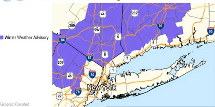
This advisory affects the following counties:
10 p.m. Sunday to 11 a.m. Monday:
- Western Passaic (NJ)
- Orange (NY)
- Rockland (NY)
- Putnam (NY)
- Northern Westchester (NY)
1 a.m. Sunday to 11 a.m. Monday:
- Northern Fairfield County (CT)
- Litchfield County (CT)
- Northern New Haven (CT)
- Northern Middlesex (CT)
Residents in Northern New London County (CT) should also stay alert, as the advisory may extend to their area, the National Weather Service added.
Expected Conditions:
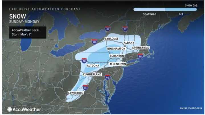
- Precipitation: Light snow is predicted to begin late this evening in parts of the Lower Hudson Valley and northeastern New Jersey, spreading eastward into Connecticut overnight. The snow is expected to transition to freezing rain early Monday morning and then to plain rain by mid-morning.
- Ice Accumulation: A light glaze to several hundredths of an inch of ice is possible, particularly on untreated and elevated surfaces.
- Snow Accumulation: Generally, accumulations will be an inch or less, with some areas in western Orange County potentially receiving up to 2 inches.
Impacts:
- These conditions are likely to create hazardous travel during the Monday morning commute, especially on untreated roads, bridges, and overpasses.
Forecast Challenges:
- The precise timing of the changeover from snow to freezing rain remains uncertain.
- The duration for ground temperatures to rise above freezing is also uncertain, which could prolong icy conditions.
Recommendations:
- Exercise caution while driving during the advisory period.
- Stay updated with the latest forecasts and potential adjustments to the advisory area.
Earlier report - Wintry Mess: Updated Snowfall Totals Released For Storm Causing Slippery Travel
Check back to Daily Voice for updates.
Click here to follow Daily Voice Rivertowns and receive free news updates.

