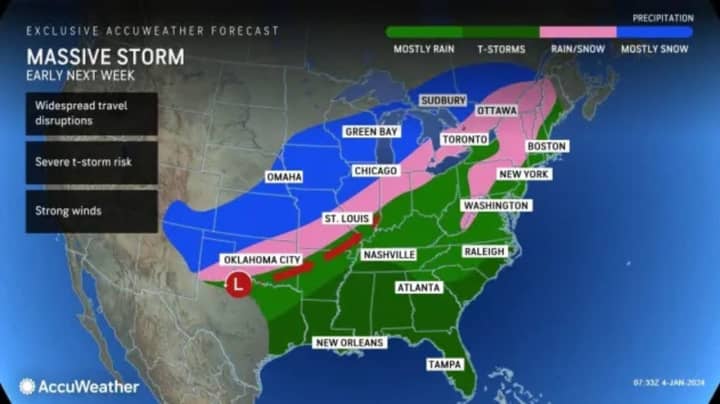
The time frame for the first system, a massive Nor'easter, is from late in the day Saturday, Jan. 6 into Sunday, Jan. 7, according to the National Weather Service. It has the potential to drop a foot or more of snow in areas farthest inland and a widespread 3 to 6 inches in most areas farther off the coast.
The second storm is forecast to arrive on Tuesday, Jan. 9, and currently looks to be a rainmaker with gusty winds that could cause power outages and the storm lingers into early Wednesday, Jan. 10.
“Locations in the Northeast that receive a half foot of snow from this weekend's storm are unlikely to be hit with significant snow twice in one week," said AccuWeather Sr. Director of Forecasting Operations Dan DePodwin. "Instead, next week's storm brings the risk of heavy rain and damaging winds in this area of the country. This raises the concern for flooding due to the combination of rain and snowmelt, along with power outages due to strong winds."
For the latest projected snowfall totals for the weekend Nor'easter, click on the second image above.
Less snowfall is expected along the coast, where there will be a mix of snow and sleet with projected snowfall of between 1 and 3 inches.
With potentially damaging winds at times from the storm, power outages are possible from the first storm, including farther south where there will be little snow accumulation, including New York City and Long Island.
During the weekend storm's height, winds will be out of the Northeast at 20 to 25 miles per hour with gusts of 35 to 45 mph, with strongest gusts near the coast, especially in areas farthest east.
It will be colder on Friday, Jan. 5 with a high in the mid-30s and wind-chill values in the teens and 20s.
Clouds will increase on Saturday in advance of the storm's arrival. The high temperature will be in the mid-30s.
According to current models, most of the snowfall will be between late Saturday night into Sunday morning and should wind down Sunday afternoon.
"Travel conditions can rapidly deteriorate throughout Saturday and Saturday night as snow and ice spread across the region," AccuWeather.com says.
As for the second storm, current forecast models predict that the heaviest rain and strongest winds will come on Tuesday night.
This continues to be a developing story. Check back to Daily Voice for updates.
Click here to follow Daily Voice Ramapo and receive free news updates.


