Thursday, Dec. 16 will seem more like mid-April than mid-December, with the highest climbing to the low 60s with a mostly cloudy skies and peeks of sun at times followed by a chance of late-evening showers.
Friday, Dec. 17 will be mostly sunny with a temperature falling into the upper 40s by late afternoon as a front arrives that will lead to the first round of precipitation overnight, with areas farthest north and inland seeing a mix of rain and sleet.
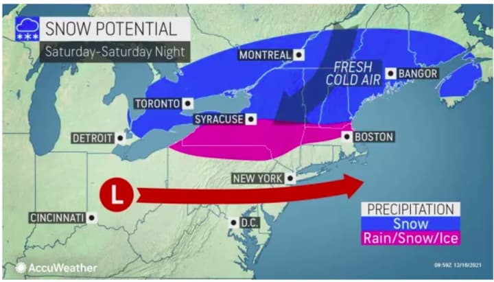
Saturday, Dec. 18 will be dreary with rain at times during the day, with areas shown in the image above seeing a mix of rain and sleet, and areas farthest north seeing snow.
Parts of northern-most New York and New England (the areas in blue in the image above) could see up to around 2 inches of snowfall accumulation.
Precipitation will continue at times Saturday night until around midnight Sunday, Dec. 19.
Skies will clear for the second half of the weekend, with mostly sunny skies on Sunday and a high temperature in the upper 30s.
Check back to Daily Voice for updates.
Click here to follow Daily Voice Ramapo and receive free news updates.


