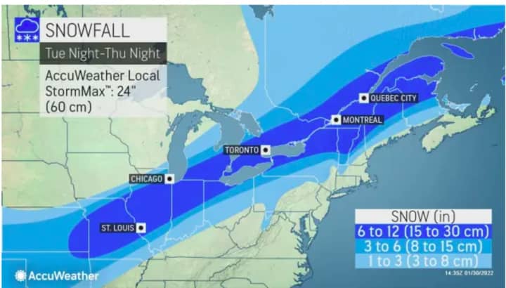
But unlike the weekend Nor'easter which hit coastal areas the hardest, these upcoming systems are expected to track much farther north and inland.
Monday, Jan. 31, and Tuesday, Feb. 1 will both be sunny, cold, and dry with wind-chill values in the single digits before the unsettled pattern arrives at midweek.
The first storm system moving from the west to east will mainly affect upstate New York and northern New England on Groundhog Day, Wednesday, Feb. 2 into Thursday, Feb. 3.
According to AccuWeather.com, as much as 6 to 12 inches is expected in areas farthest north. (Marked in dark blue in the image above.) Between 3 to 6 inches is being predicted in areas in blue, and 1 to 3 inches in those parts of the region marked in Columbia blue.
The next system could bring more snow farther north and inland during the day on Friday, Feb. 4. Areas closer to the coast should see all rain. The snow chance will continue into Friday.
There's uncertainty surrounding the track and strength of that late-week system, and it's too early to make predictions for potential snowfall.
Check back to Daily Voice for updates.
Click here to follow Daily Voice Ramapo and receive free news updates.


